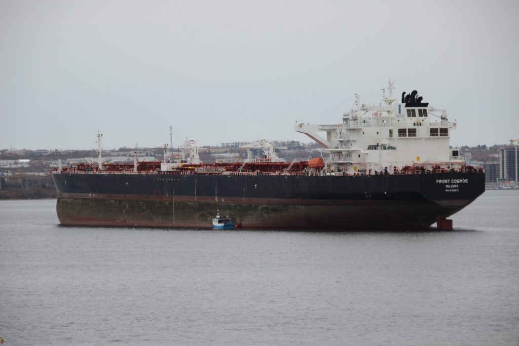
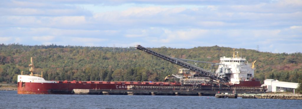
The Crude oil tanker has taken a far northern anchorage in the basin suggesting the ship is planning to stay a while while looking for its next gig. the ship arrived from Saint John NB after discharging its cargo.

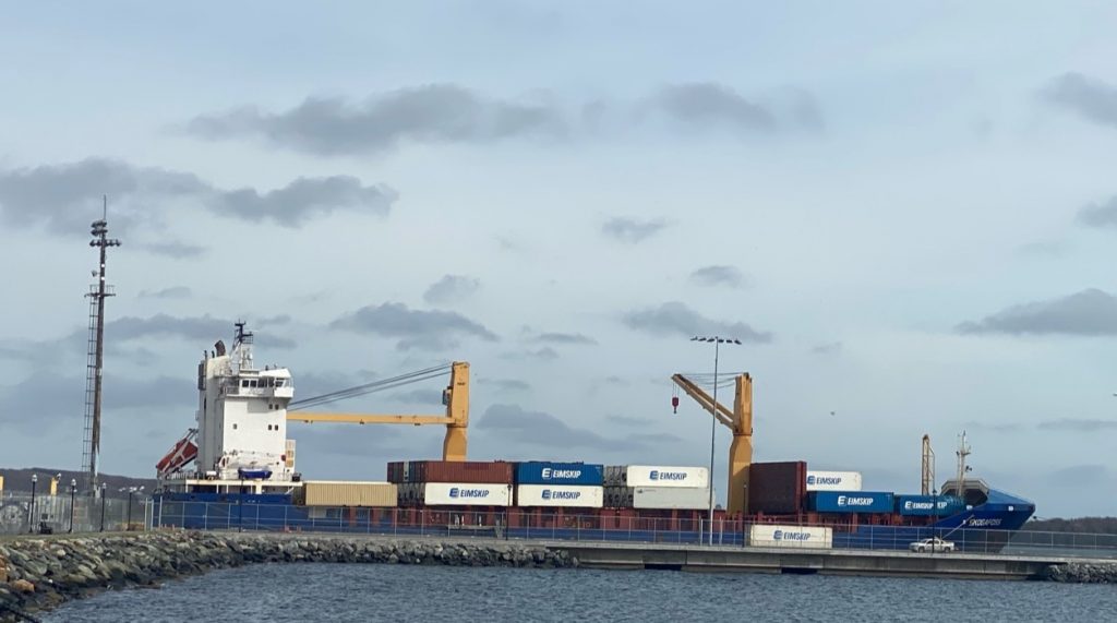
The new Pier extension is great for photographing the smaller ships that call at PSA Halifax, as it provides an almost unobstructed view of the vessel.
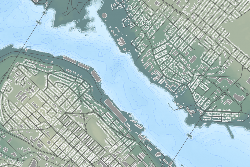
the pedestrian lookoff is back, though some handrails remain to be installed, before it can be open to the public again.
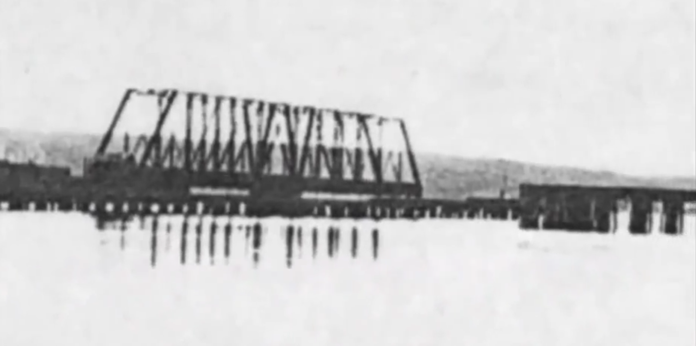
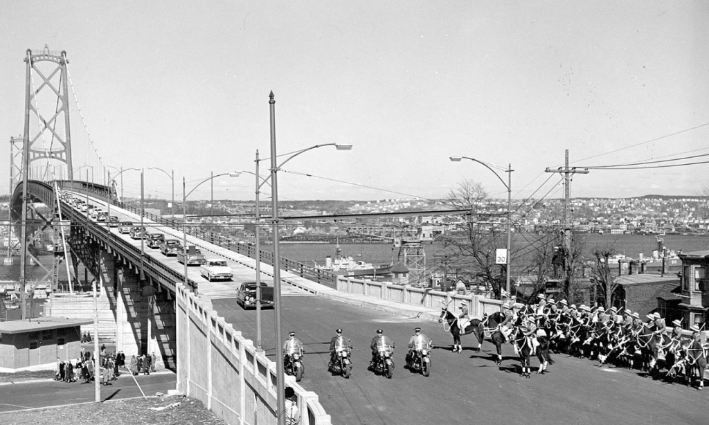
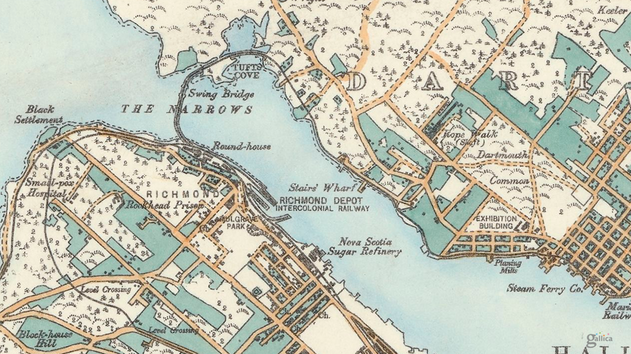
The first bridge spanning Halifax Harbour was a railway bridge constructed by the Intercolonial Railway at the Narrows. It was constructed between 1884-85 and was 650 feet long.
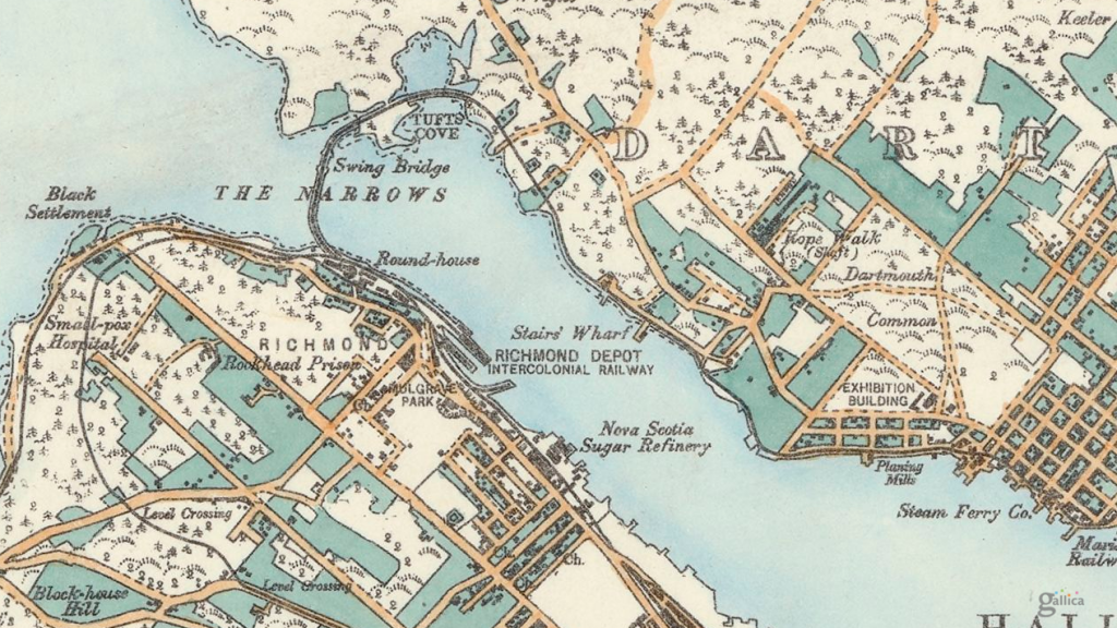
Intercolonial Railway engineer P.S. Archibald designed the bridge in a concave form with the convex facing Bedford Basin in the hope this shape would help the bridge withstand ice slides each spring.
A Dartmouth man, Duncan Waddell, was in charge of construction for the huge stone pier upon which the swing section or “draw” of the bridge would rest, so vessels could be allowed to move into Bedford Basin. The stone pier, located near the Dartmouth shore, was constructed in about 35 feet of water, by driving piles into the gravel bottom to a depth of five or six feet. These acted as guides for building the pier, which was to hold the bridge, being built by the Starr Manufacturing Company of Dartmouth.
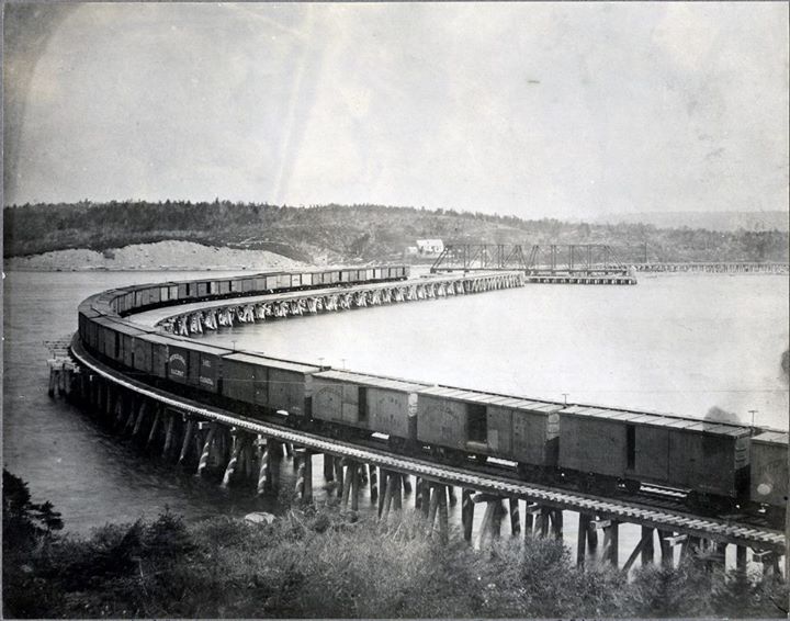
The wooden trestle-work of the bridge, constructed by M.J. Hogan of Quebec, rested on eight foot stone-filled cribs, spaced on the harbour bottom every 10 feet (3.0 m). The piles were then secured to the cribs. As the depth of the water was about 75 feet the piles had to be built in three sections, and spliced with eight-inch deals (basically an 8″ long plank) spiked into place. This proved to be extremely weak, especially when no form of side-bracing was used.
A hurricane hit Halifax on Monday evening September 7, 1891. The storm caused damage to wharves and shipping in harbour. The bridge was destroyed. Nothing remained the next morning but a few broken timbers and some trestles in shallow water.
Suggestions were put forward by Dartmouth Town Council that it would be better to construct the railway line along the shoreline from Bedford to Dartmouth, rather than rebuild the bridge. However, the federal government decided to rebuild the structure, stating that the land route was not “deemed advisable.” Like the first bridge, it was poorly constructed and not braced. This time it was built in a straight line and thus made much shorter. Completed in 1892, the contractor was Connor’s of Moncton, New Brunswick.
About 2:00am, on July 23, 1893, almost two-thirds of the bridge slipped into the water. The last train had crossed about 6 hours prior. The cause of the breaking away of the Narrows Bridge was to be the result of sea worms. It was discovered that the piles were worm-eaten almost through between high-water and low-water mark. When the last train went over, it is assumed that these rotten supports gave way, but remained resting on the surface. Then, when the tide rose, the bridge desk floated up and the whole thing swept away.
The loss of the second bridge then led to the establishment of the rail line to Windsor Junction in 1896. The third harbour crossing is the Macdonald bridge.
The firm of Monsarrat and Pratley were engaged to carry out studies of a possible high-level highway bridge linking the 2 sides of the harbour as far back as 1928. The bridge location between North Street in Halifax, and Thistle Street in Dartmouth was approved by Dominion Authorities and the British Admiralty in 1933. The 1945 master plan for Halifax assumed that this would be the location for the bridge, and suggested widening North Street to accommodate traffic. Dartmouth’s master plan of 1945 also assumed this would be the location.
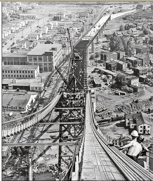
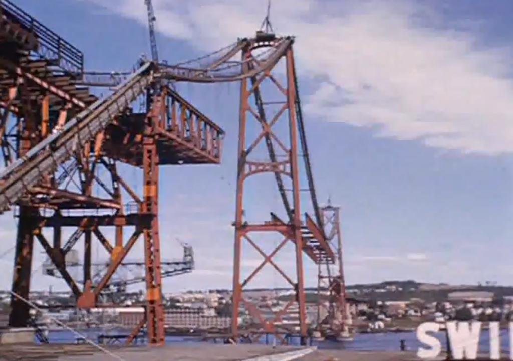
The bridge was designed by Philip Louis Pratley, one of Canada’s foremost long-span bridge designers who had also been responsible for the Lions Gate Bridge in Vancouver. By the time design work began in 1950, he was working alone. The contractor was Dominion Bridge Company Ltd. When erected at a cost of CAN $10.75 million, the Macdonald Bridge was the second longest span of any suspension bridge in the British Commonwealth, after only Vancouver’s Lions Gate.
Pratley worked on many of the large bridges in Canada, including the Jacques Cartier in Montreal, the Quebec Bridge, and the Saint John Highway Arch Bridge. One of the lesser known landmark bridges designed by Pratley was the Sheet Harbour Bridge (1957–1958), crossing over the East River at Sheet Harbour, Nova Scotia. On its erection, the through-steel arch structure of 465 ft span was the second longest-span highway bridge in Nova Scotia. It was replaced in 2015. Pratley was also appointed to the American committee formed to investigate the failure of the Tacoma Narrows Bridge.
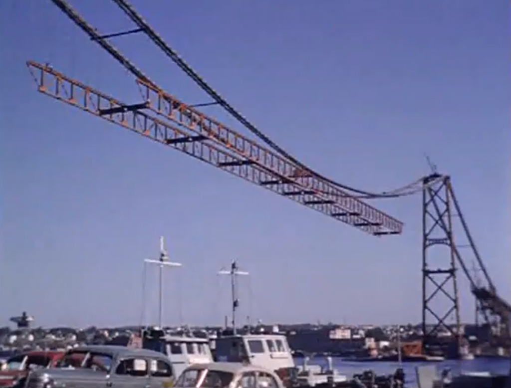
The Dominion Bridge Company itself was formed in 1896, and lasted until 1998, when it went bankrupt after purchasing the MIL Davie Shipyard. The last remaining Dominion Bridge facility is a plant in Amherst, operated by the Cherubini group, who will be doing the steel fabrication of the new pieces for the bridge. Pratley’s son Hugh was involved in the site supervision and took over the operation of the consulting firm on the death of his father in 1958. Construction on the Macdonald Bridge began in 1952, and took 3 years. During construction, 6 workers were killed.
The Macdonald Bridge opened to the public on April 2, 1955.
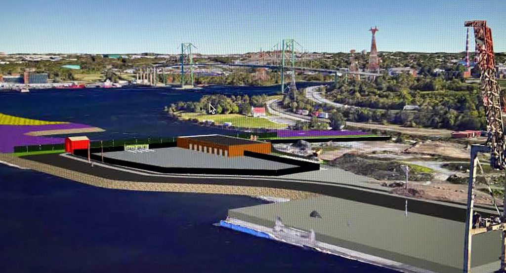
Thanks to a presentation posted on the cities public consultation website Shape Your city, we now know what the new truck access to Fairview Cove will look like.
This access will be used to handle the majority of container traffic bound for both the Fairview Cove and PSA halifax terminal in the south end. the new access is off Africville road, in the general area where the dump trucks now access the infill area. Containers bound for PSA Halifax will be loaded on rail cars for transport to the other terminal.
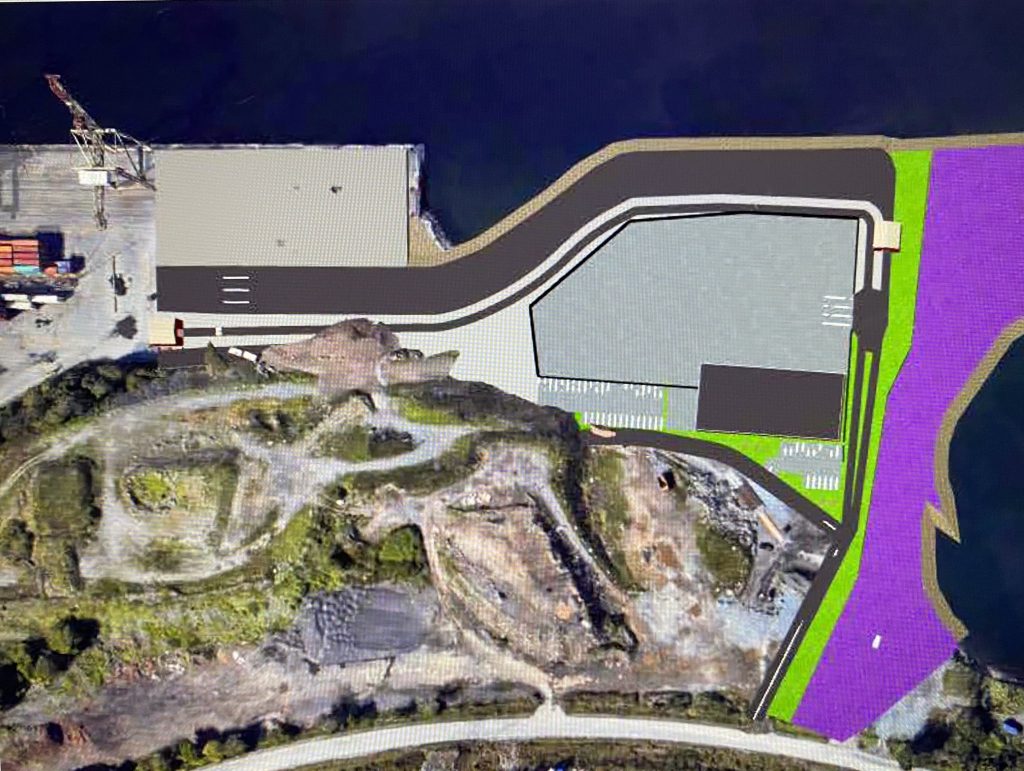
Besides the truck access, the facility will feature a new inspection facility, presumably for use by CBSA to inspect suspect shipments before being forwarded on. that facility will include a shed, and a fenced in yard.
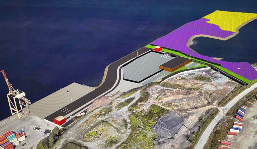
There is no word yet on the changes to the Windsor street exchange to improve access to the site, however the moving of the truck access will free up land making more space available for whatever the final result is.
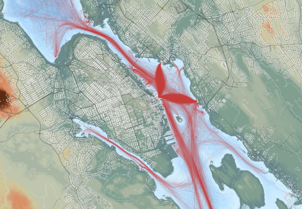
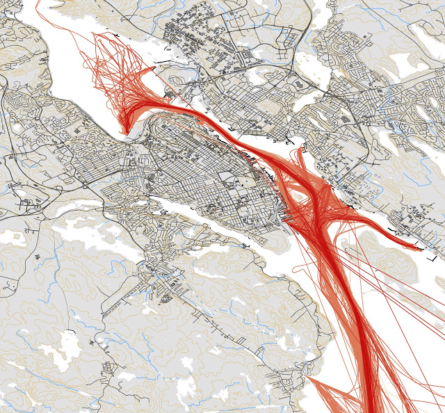
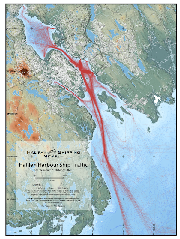
Well, its time for an updated map. This version is based on data from the month of September 2020. Its available as a pdf download (31mb).
2020 brought alot more traffic to be mapped versus the previous 2 versions, based on increased adoption of AIS. The Navy’s tugs now show on AIS, and the new Jetty NJ is in use at the dockyard. COVE has traffic, and Dominion Diving vessels are visible coming out of Dartmouth Cove. The Irving Woodside oil dock is in use, and we have trips to Georges island.
(below left) Fishing vessels in Dartmouth Cove. (below right) Boats at Anchor in the North West Arm.
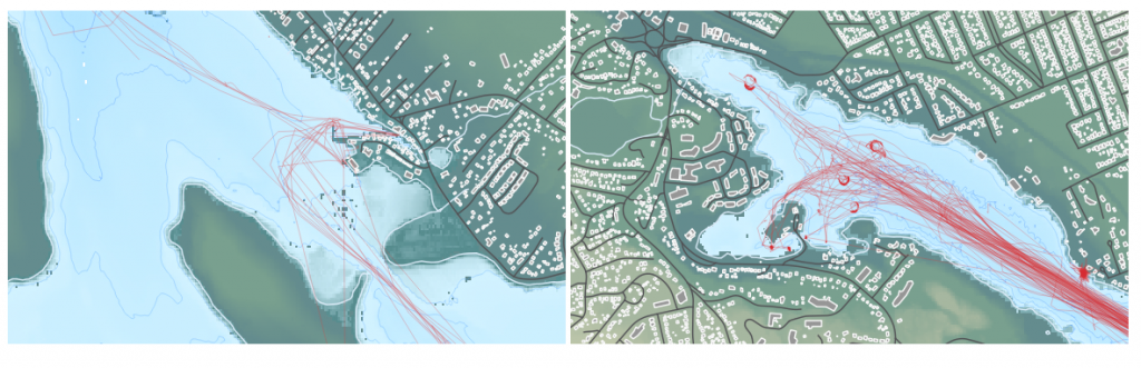
(below)Boats at the Dartmouth Yacht Club.
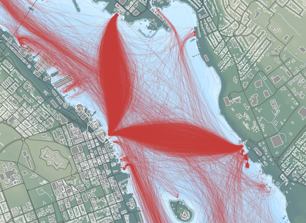
The 2020 Map was again made in QGIS, and this time made use of several open data sets. The land is based on the 2018 LIDAR 5m DEM (Digital Elevation Model) coloured to denote elevation. The city is made form the road center lines, coloured dark grey, and the Building Polygon’s, from the Building Outlines data coloured light grey.
The waters of the harbour were built with the CHS NONNA 10 data set. The GeoTiff’s were downloaded, merged into a single file, the colored to show depth. Vector contours were generated, and are visible as a subtle detail in the waters.
Otherwise, the same basic process was followed as outlined in my 2016 how its made post
Going Back In time
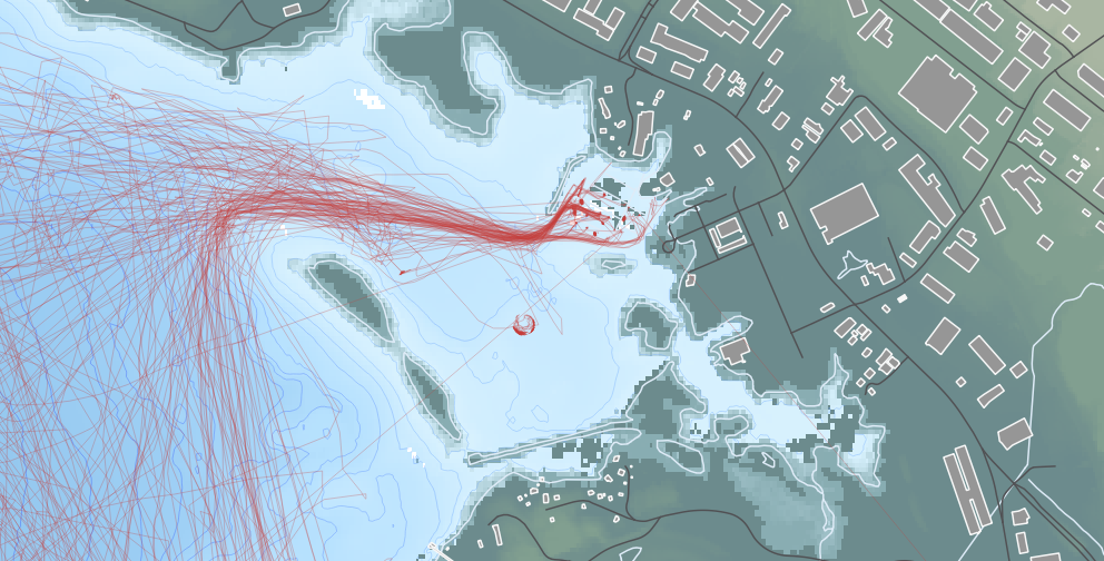
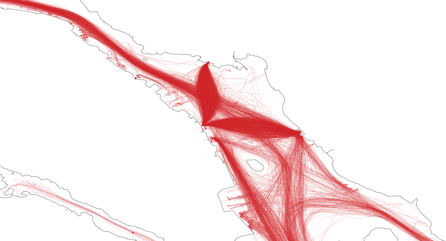
The first map was based on traffic in Nov 2011. COVE was still in use by the coast guard, so traffic is visible. the Ferries are absent, as they didn’t carry AIS in 2011. Imperial Oil is still seeing tanker traffic.
The 2011 map was made in ESRI ArcGIS, and the basemap came from a web mapping service. For 2016, the map was made in QGIS, and the line whights were made finer, with a simpler outline of the harbour.
The traffic in August 2016 is quite different. the Ferries have left a clear Whale tale mark where they cross to Alderney and Woodside. COVE is not yet in regular use, and has limited traffic. There is much less traffic to Imperial oil.
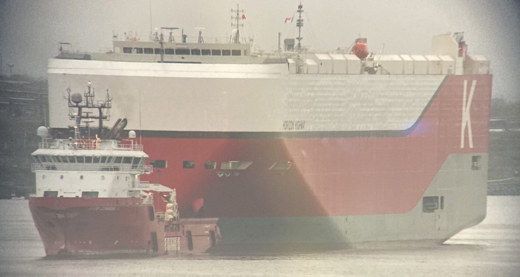
The Pure Car Truck Carrier Horizon Highway was towed into Halifax this morning by Siem Commander. The Horizon Highway tied up at Pier 9 with tug assistance.
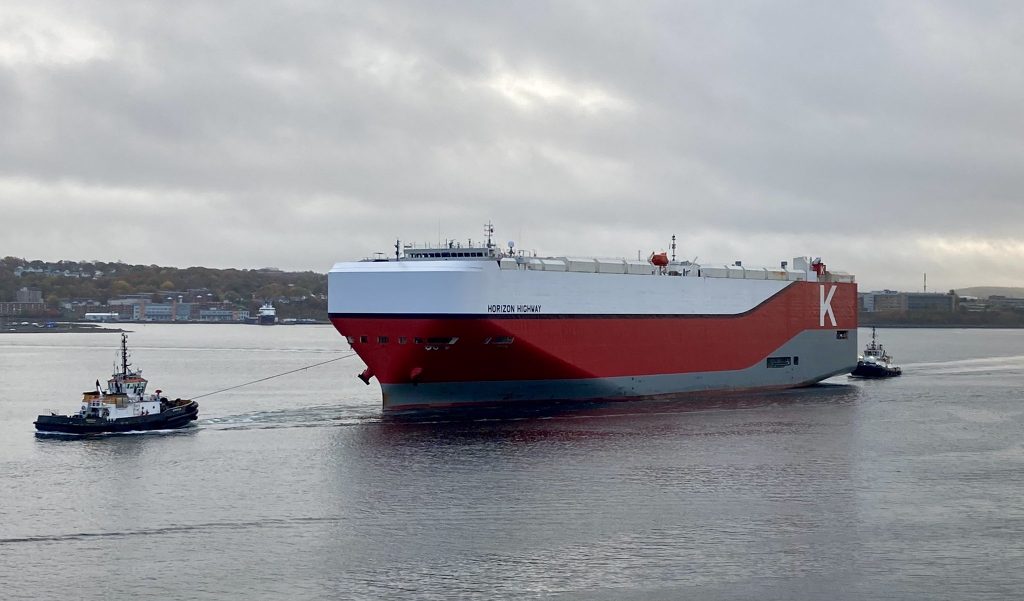
The Horizon Highway Sailed from Southampton on the 9th, and looks to have lost power on the 15th, and drifted before regaining power, or being taken under town by another vessel on the 16th. It was suggested that the main engine was vapor locked.
the Siem Commander sailed from Halifax the morning of the 19th.
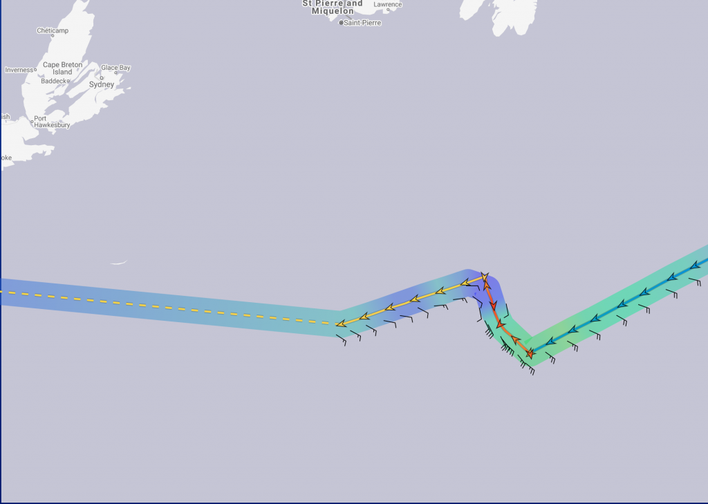
This is yet another case of Laid up Secunda vessels providing emergency assistance. Venture Sea was recently dispatched to tow the Golden Opal, a bulk carrier that became disabled in the Davis Straight after departing the Baffinland mine in Mile inlet bound for Immingham, England. Both those ships are now in Nuuk Greenland.
Nautical Mayday is back for Season 2 on the Discovery Channel.
Season 2 of Disasters at Sea Premiers Sunday Evening (Oct 18th). If you missed season 1, you can catch up for free right now on the Discovery Channel website. (or via the app) https://www.discovery.ca/Shows/Disasters-at-Sea

Season 2 of DISASTERS AT SEA starts with the 2006 sinking of B.C. passenger ferry Queen of the North, which struck an underwater ledge off Gil Island carrying 101 passengers – all but two of which were rescued by Gitga’at First Nation residents in Hartley Bay.
The Other 5 Episodes:
The Arctic Rose Mystery , Airing Oct. 25
The catastrophic loss of fishing vessel Arctic Rose is made more mysterious by the fact that only the captain had time to put on his survival suit. Searching for answers, investigators send an ROV to survey the sunken wreck and uncover an intriguing clue that ignites controversy among their own ranks.
Firefight, Airing Nov. 1
A routine ferry trip turns deadly when the MS Norman Atlantic burst into flames, trapping more than 400 passengers on board and killing more than 30 people. Why did a modern passenger ferry catch fire? And why did the evacuation go so wrong?
The Sinking of the Lady Mary, Airing Nov. 8
When a family-owned scallop vessel sinks in the middle of the night, even the lone survivor isn’t sure what happened. Investigators have two mysteries to solve: What sank the Lady Mary, and why did only one person live to tell the tale?
Storm Watch, Airing Nov. 15
The containership SS El Faro goes down just 20 miles from the eye of Hurricane Joaquin killing all 33 of the crew. With the shipwreck and all the evidence at the bottom of the sea, investigators must go to enormous lengths to recover the ship’s black box and find out what went wrong and why?
Death on the Staten Island Ferry, Airing Nov 22
A routine trip on New York’s Staten Island ferry turns deadly when the ship slams into a pier at high speed, killing 11 people and injuring dozens more.
DISASTERS AT SEA is produced in a purpose-built studio in Hamilton, Ont. and on-location throughout Canada and the U.S. The Producers provided a set tour, so you can get a sense of what goes into making the show.
The series, which recently wrapped post-production on Season 3, has been sold in more than 100 markets worldwide, including Eastern and Western Europe, as well as Australia.