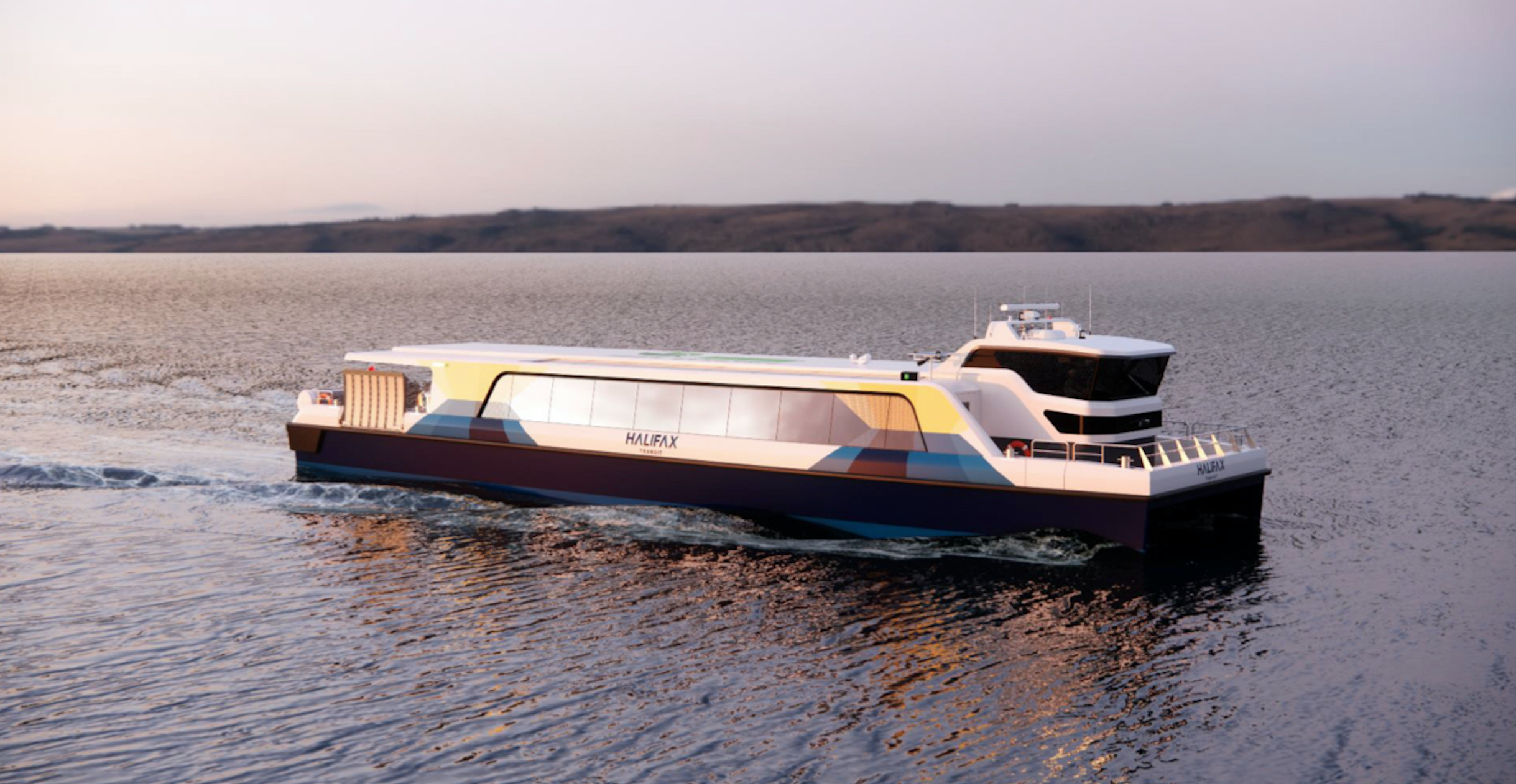
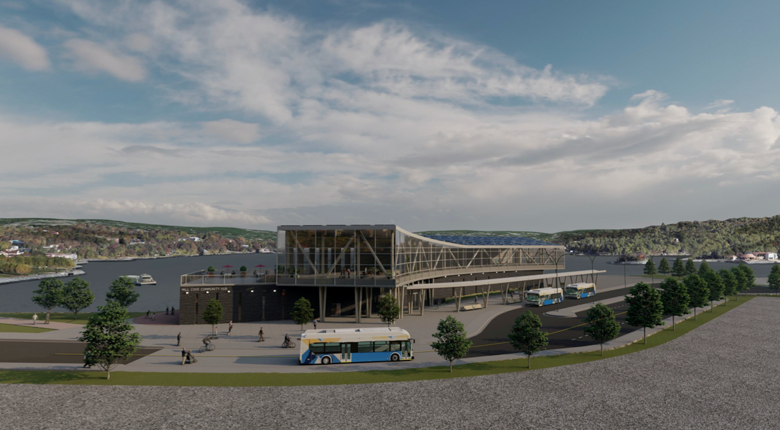
Councillor Tim Outhit released some renderings of the proposed electric Catamaran Fast Ferries, and the Proposed new Terminal at Mill Cove, which will also include a New Bedford Library and Community Space.
The City received some federal funding to do preliminary designs for the service, and with that work now complete, applications have been put in for additional funding for the project. The total estimated capital cost is 288 million, not including the Library portion of the new building.
The Project will also require a new Halifax Ferry Terminal Downtown.
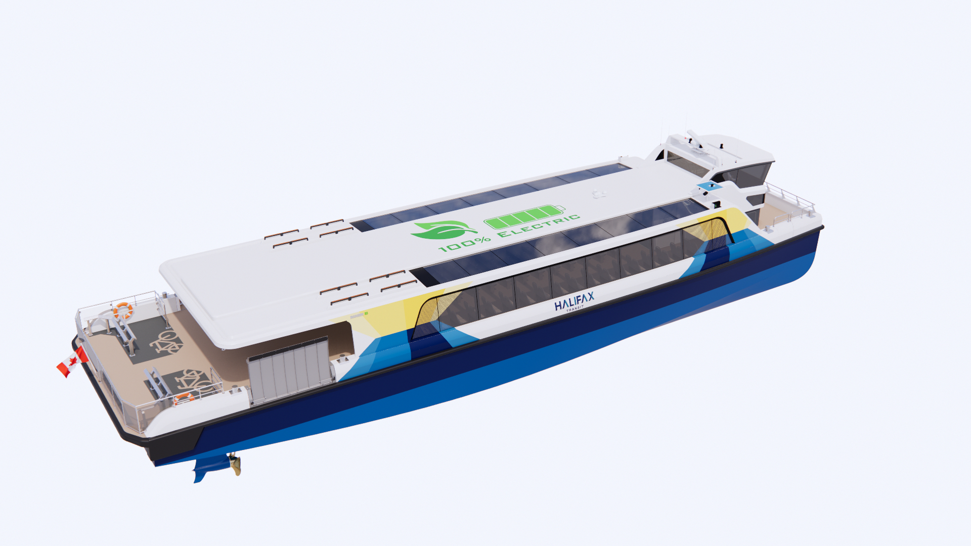
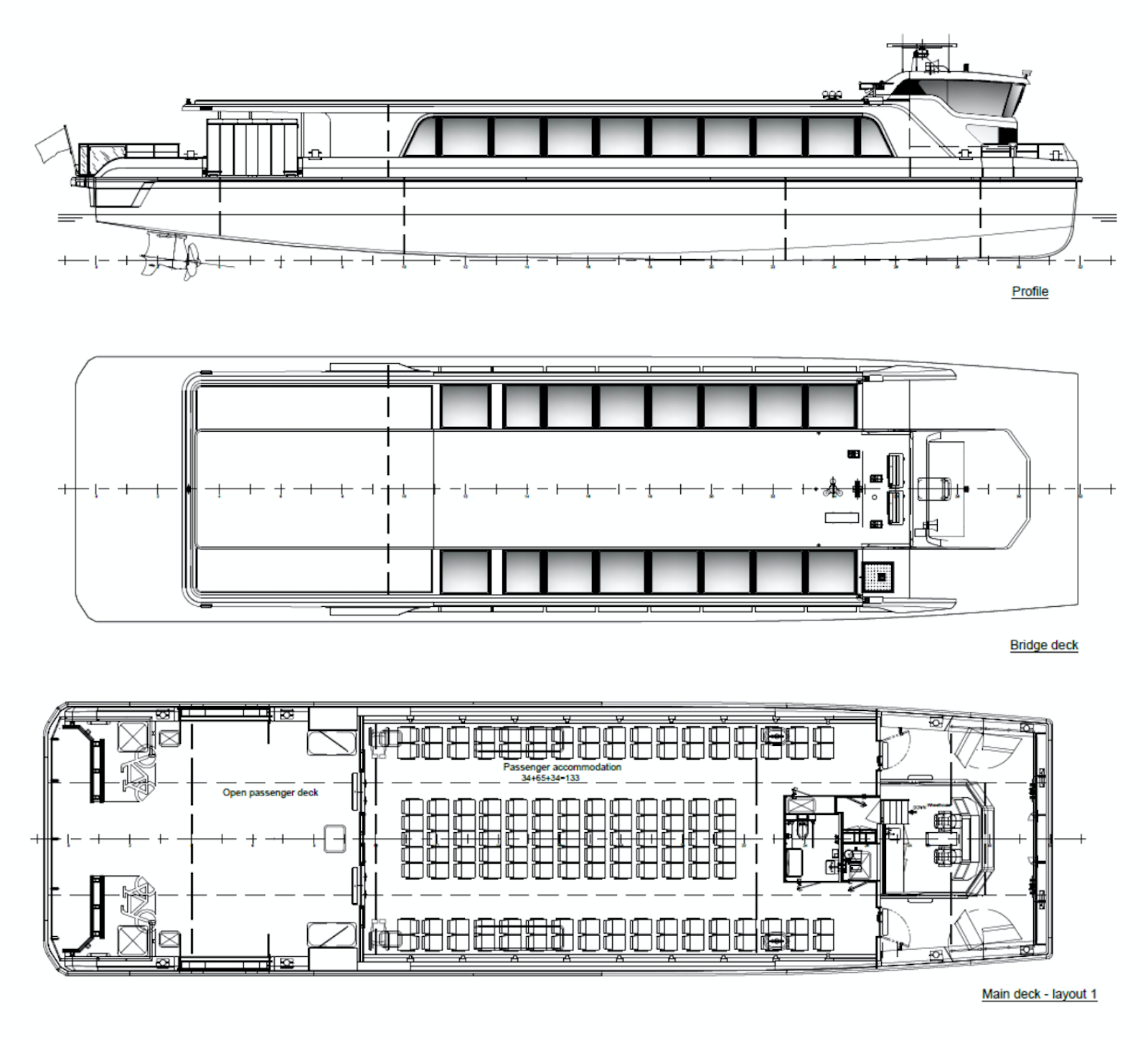
The new passenger ferries will be electric, and there will be 3 routes – Shannon Park, Larry Uteck, and Millcove. The New ferries will not have an upper deck, but will have a covered outdoor space at stern, and additional space at the bow.
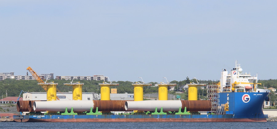
GPO Sapphire arrived earlier this month with the next set of piles and Transition Pieces for the Vineyard wind 1 Project. The Installation vessel Orion will return to load these, once its completed installing the first 6. A total of 11 trips will be needed, And All 4 GPO Vessels will rotate through the delivery duties.
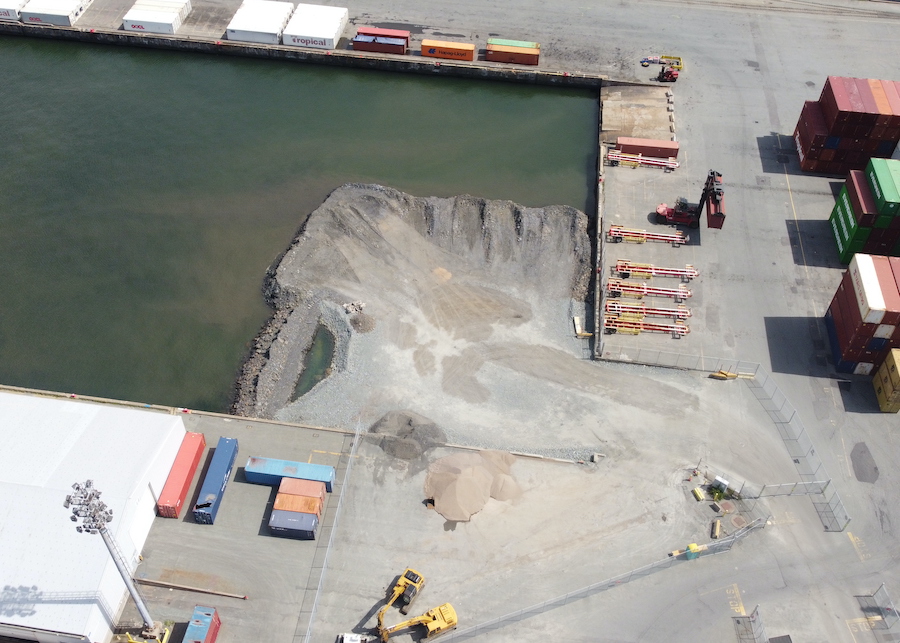
Current progress on infiling at the Ocean Terminals. Most of the fill looks to be concentrated off the end of the Pier 34 RO-RO Ramp, but is likely wider below the Surface.
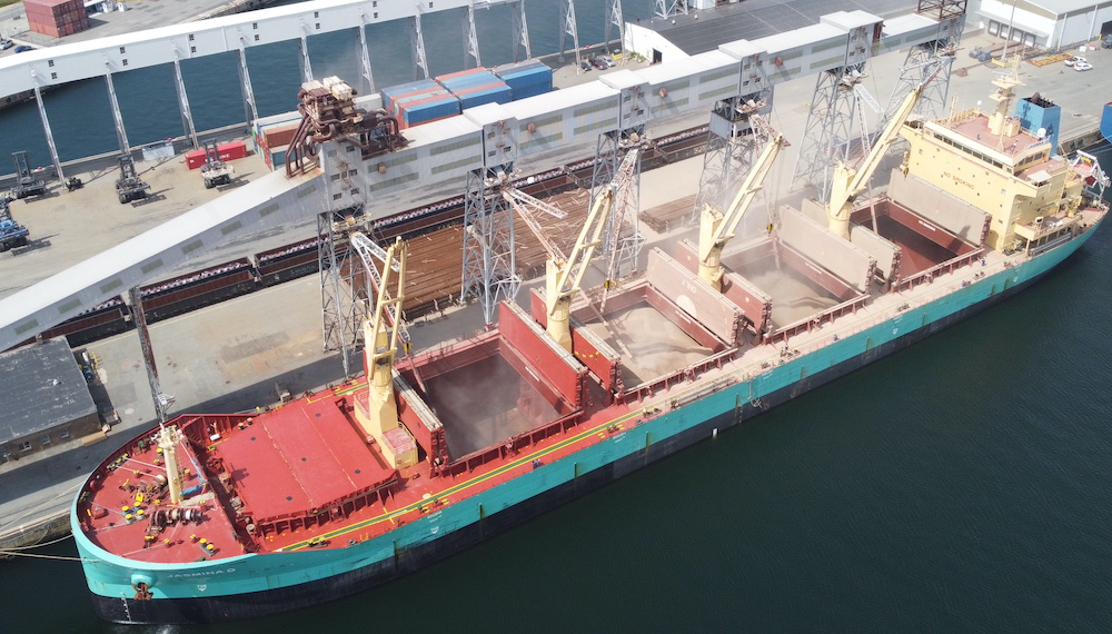
The bulk Carrier Jasmina D loading product at the Halifax Grain Elevator. The Malta registered ship was built in 2012. Jasmina D is 180m and 30m Wide. The ship comes in at 35000DWT, making at a Handysize Bulk Carrier, which includes vessels up to 50000DWT, which are small enough to fit into most ports.
Loading operations often produce a dust clould, and you can clearly see the accumulation around the aft 3 holds. Ships must be loaded in a certain order to ensure they dont loose stability during loading.
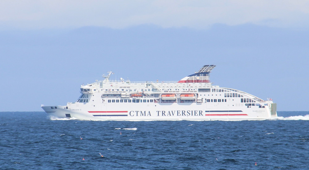
The Madeleine II passing East Point PEI, having sailed from Souris for Cap-aux-Meules, Iles de la Madeleines. The Ferry was built in Spain in 2018, and acquired by the feds for the service to replace the aging Madeleine.
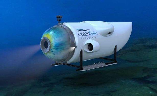
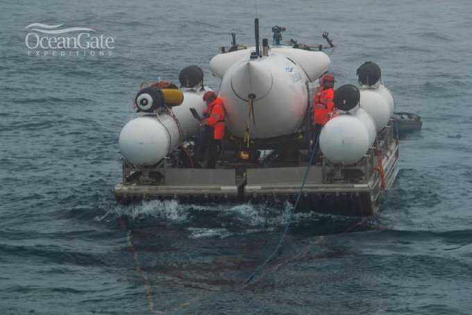
The Titan Submersible, operated by OceanGate Expeditions has gone missing on a trip to the titanic wreck site. The Polar Prince was serving as mothership for the Expedition.
we know know that the submersible went missing 1 hour and 45 minutes into the dive. It takes around 2 hours to reach the titanic from the surface. dive preparations began around 4am Sunday morning, with the dive beginning at 6am, suggesting the submersible has been missing since 8am Sunday. the USCG indicated they were informed the submersible was missing Sunday afternoon. Word of the missing vessel got out around 10am AST Monday. The Titan submersible can support life for 96hours.
The Response is being co-ordinated by USCG NorthEast sector, based out of Boston. the USCG sent 2 c-130 aircraft to search the surface incase the submersible had surfaced. the 106th US Air national Guard also has c-130’s searching. the RCAF sent a C-130 to search, and a CP-140 Aurora was dispatched to deploy sonobouys to listen to for possible signs of the submersible. Polar Prince is equipped with sonar.
The CCGS Kolpit Hopson 1752 is on scene, the Horizon Arctic was initially dispatched, but has since turned back for St. John’s, replaced with the Skandi Vinland, equipped with an ROV.
the Titan Submersible is rated to 4000m (13123′) of depth. Its constructed of carbon fiber and titanium, and propelled by 4 innerspace 1002 electric thrusters. Titan is 23′ long, 9.2’wide, and 8.3’tall. it carries a pilot and crew of 4.
there are several possibilities as to what happened. the first possibility is an electrical issue, and the sub is unable to propel itself or surface. its possible the submersible is snagged on the wreck itself, and unable to move as a result. the last possibility is that the Titan suffered a structural failure, and was crushed.
Retired RN Rear Admiral Chris Parry indicated he has been contacted by a reliable informant who claims to have warned about structural issues in the Titan 5 weeks ago. Reporter David Pouge took a trip on Titan last year. That saw Titan go missing for several hours, though in that instance it was in communication with the mother ship. his stories are interesting, the sub is controlled by an xbox controller. Pouge indicates that Titan has several redundant systems to enable the submersible to surface, including air bladders and ballast. (Pouge’s report was for CBS, and it is available on Youtube, but not to Canada.
I have been maintaining a twitter thread on this story, continuously updated. This post will get updated, likely at the end of the day.
UPDATES: on Tuesday it was reported that knocking was heard by the CP-140 aircraft. ROV searches were adjusted to focus on the area where the knocking was detected.
The USAF flew three c-17’s of equipment to St Johns, and it was loaded aboard the Horizon Arctic. the Equipment includes a Pelagic ROV system, and the USN’s Fly Away Salvage system. Horizon Arctic Sailed for the site at 5 am Wednesday, its a 20 hour sail.
Also due tonight is the french research vessel L’Atalante. It’s operated by French research institute Ifremer, and was requested by the USN. The Victor 6000 is an autonomous robot, good to 6000m.
More stories about Ocean Gate Expeditions have been coming out. First were the details of lawsuits with a former employee who was fired after raising safety concerns, including that the porthole manufacturer would only certify it to 1300m and not 4000. Additional Stories are coming out about previous passengers who took a trip on the submersible.
the 96hours of life support runs out Thursday morning. that is likely not a hard deadline, but time is running out for a rescue.
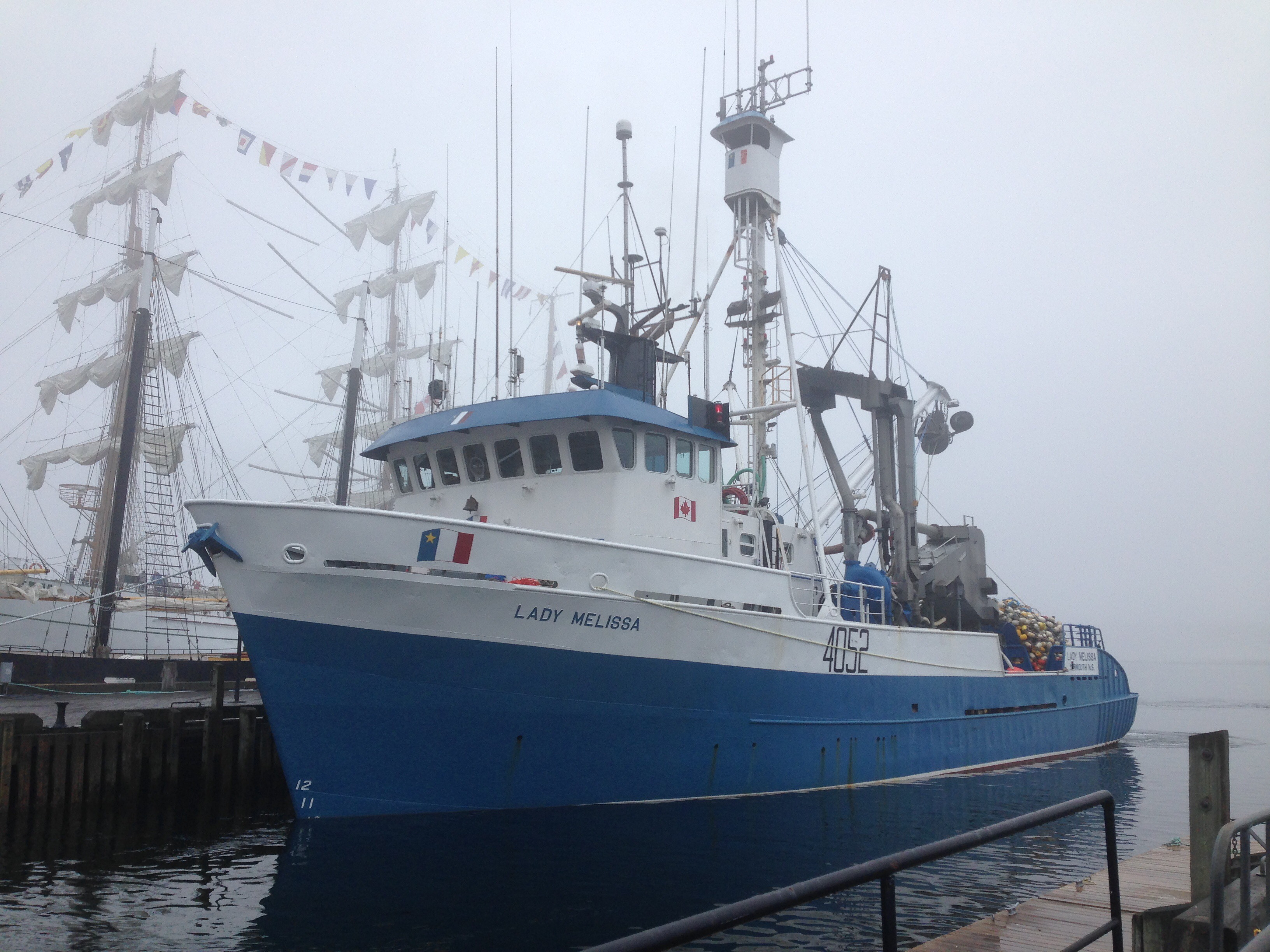
The Herring fleet has been back to calling in Halifax. Lady Melissa and and Morning Star both have put into port to offload at pier 9. Unlike previous years, where the ships hung out on the waterfront, they proceeded directly back to sea.
Low fish stocks have led to reductions in quota the past few years – the fleet was last here in 2019, though this year only the 2 vessels have called so far this year
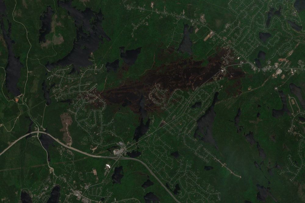
I recently tweeted this map of the Tantalon fire burn scar, and offered up a post on how its made, if there was interest. There was, so here we go.
Sentinel-2 is an earth observation satellite (there are actually 2 in orbit) operated by the ESA. It offers 10m resolution (meaning each pixel is 10m on the ground), and passes over any given location every 5 days. 10m resolution is not super clear, but it is useful for looking at changes to the earth – like deforestation, Infilling of waterways, or tracking large fires.
The June 12th pass was the first over the Tantalon area with clear skies. From the Sentinel Hub site, you can download imagery that is georeferenced. (Free Trial Account required)
(Above) Satellite Photo from Sentinel Hub.
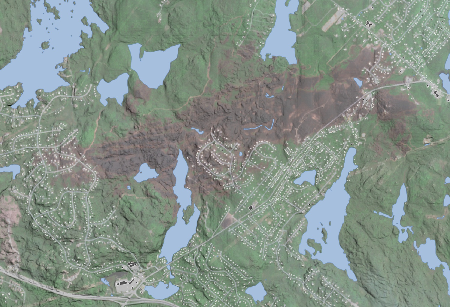
Once we have the photo, we can add other data to it in QGIS. I’m not going to go into adding and styling layers in QGIS, But you can see the layers getting added in the video below. (For more GIS How to, see How to produce a Nautical Chart and making the map)
These are the Open Data data sets I used, clicking the link takes you to the download.
Also – New Version, draped over the HRM 1m DEM, transformed into a Multi direction Hillshade with a 2x vertical exaggeration, giving a good sense of the Terrain.