Monthly Archives: October 2020

One Month of Ship Traffic – Sept. 2020 traffic

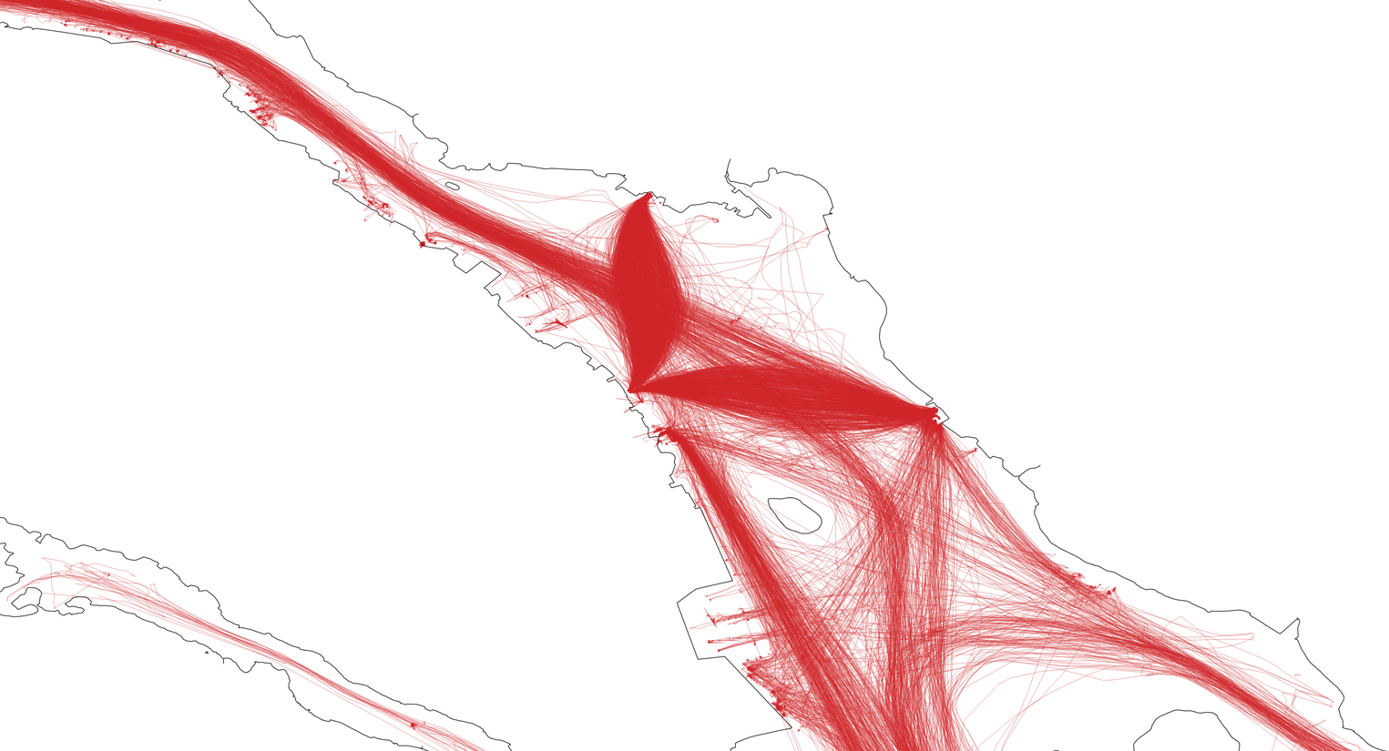
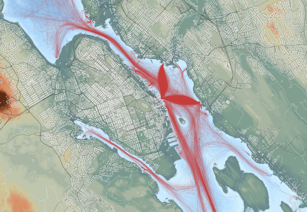
Well, its time for an updated map. This version is based on data from the month of September 2020. Its available as a pdf download (31mb).

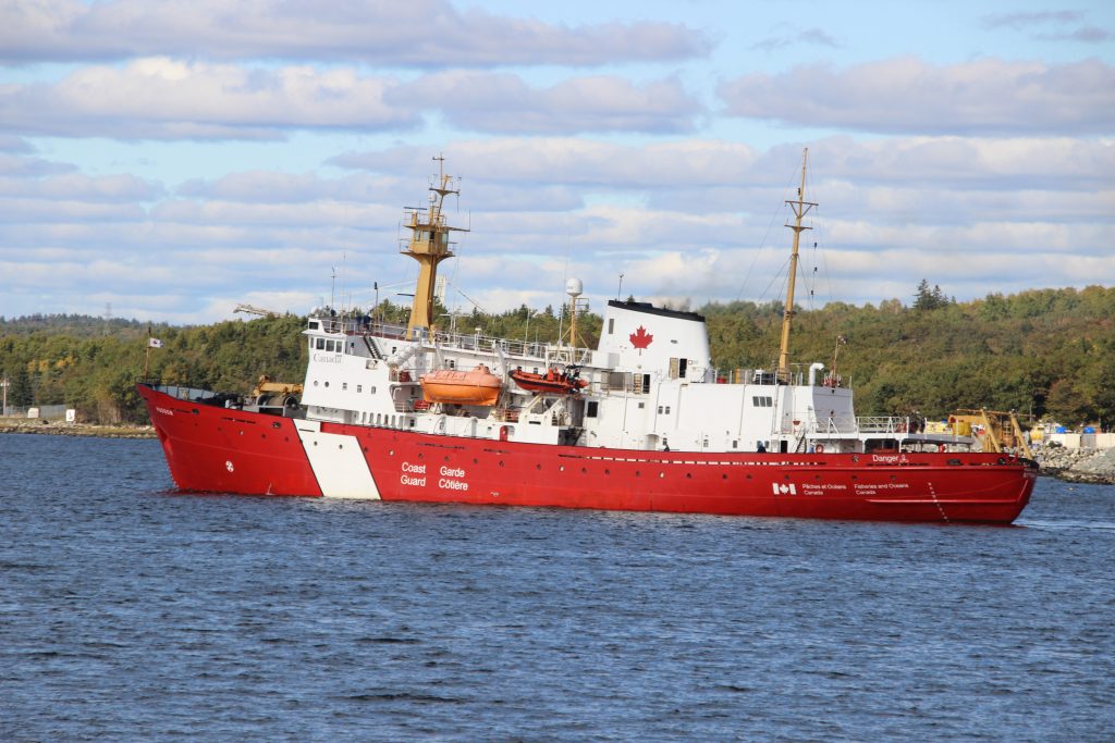
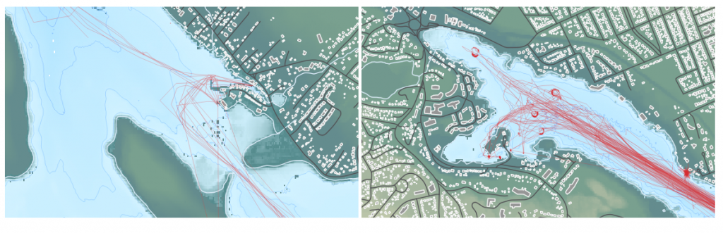
2020 brought alot more traffic to be mapped versus the previous 2 versions, based on increased adoption of AIS. The Navy’s tugs now show on AIS, and the new Jetty NJ is in use at the dockyard. COVE has traffic, and Dominion Diving vessels are visible coming out of Dartmouth Cove. The Irving Woodside oil dock is in use, and we have trips to Georges island.

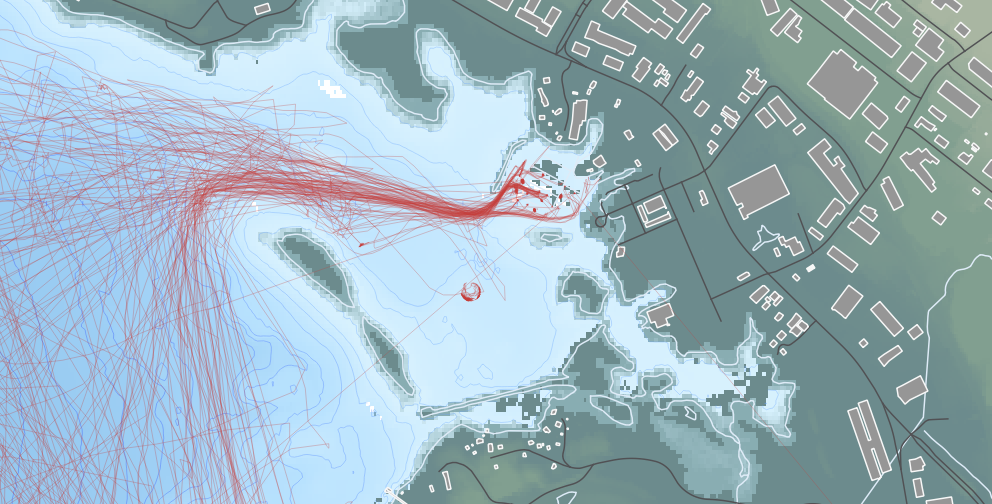
(below left) Fishing vessels in Dartmouth Cove. (below right) Boats at Anchor in the North West Arm.

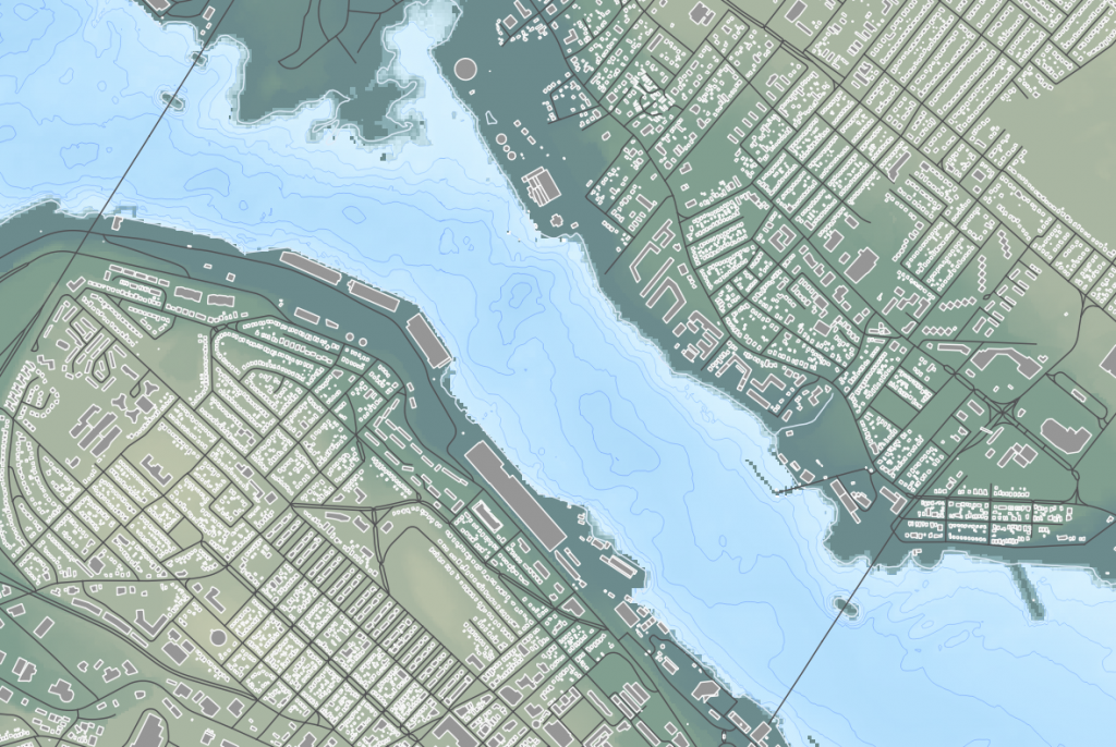
(below)Boats at the Dartmouth Yacht Club.

The 2020 Map was again made in QGIS, and this time made use of several open data sets. The land is based on the 2018 LIDAR 5m DEM (Digital Elevation Model) coloured to denote elevation. The city is made form the road center lines, coloured dark grey, and the Building Polygon’s, from the Building Outlines data coloured light grey.

The waters of the harbour were built with the CHS NONNA 10 data set. The GeoTiff’s were downloaded, merged into a single file, the colored to show depth. Vector contours were generated, and are visible as a subtle detail in the waters.

Otherwise, the same basic process was followed as outlined in my 2016 how its made post

Bathmetry of the Narrows.

Going Back In time
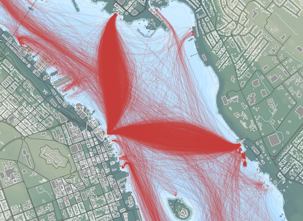
The first map was based on traffic in Nov 2011. COVE was still in use by the coast guard, so traffic is visible. the Ferries are absent, as they didn’t carry AIS in 2011. Imperial Oil is still seeing tanker traffic.

Traffic from Nov 2011.

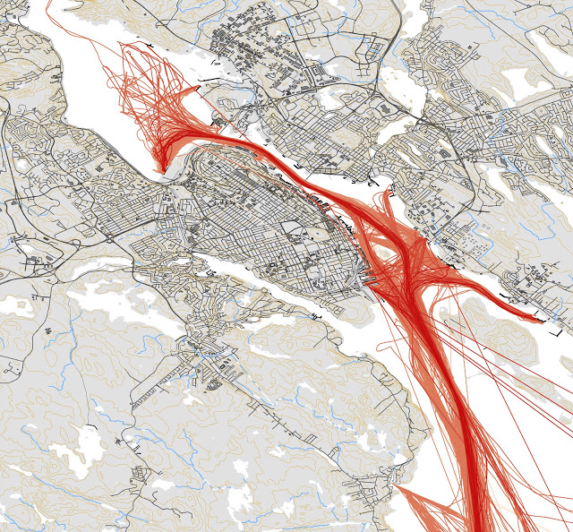
The 2011 map was made in ESRI ArcGIS, and the basemap came from a web mapping service. For 2016, the map was made in QGIS, and the line whights were made finer, with a simpler outline of the harbour.

The traffic in August 2016 is quite different. the Ferries have left a clear Whale tale mark where they cross to Alderney and Woodside. COVE is not yet in regular use, and has limited traffic. There is much less traffic to Imperial oil.

2016 traffic.

Horizon Highway gets towed in

Photo Don D’Entremont

The Pure Car Truck Carrier Horizon Highway was towed into Halifax this morning by Siem Commander. The Horizon Highway tied up at Pier 9 with tug assistance.

Photo Don D’Entremont

The Horizon Highway Sailed from Southampton on the 9th, and looks to have lost power on the 15th, and drifted before regaining power, or being taken under town by another vessel on the 16th. It was suggested that the main engine was vapor locked.

the red area is the drift.

the Siem Commander sailed from Halifax the morning of the 19th.

This is yet another case of Laid up Secunda vessels providing emergency assistance. Venture Sea was recently dispatched to tow the Golden Opal, a bulk carrier that became disabled in the Davis Straight after departing the Baffinland mine in Mile inlet bound for Immingham, England. Both those ships are now in Nuuk Greenland.

Disasters at Sea is Back.

Nautical Mayday is back for Season 2 on the Discovery Channel.

Season 2 of Disasters at Sea Premiers Sunday Evening (Oct 18th). If you missed season 1, you can catch up for free right now on the Discovery Channel website. (or via the app) https://www.discovery.ca/Shows/Disasters-at-Sea

Season 2 of DISASTERS AT SEA starts with the 2006 sinking of B.C. passenger ferry Queen of the North, which struck an underwater ledge off Gil Island carrying 101 passengers – all but two of which were rescued by Gitga’at First Nation residents in Hartley Bay.

The Other 5 Episodes:

The Arctic Rose Mystery , Airing Oct. 25
The catastrophic loss of fishing vessel Arctic Rose is made more mysterious by the fact that only the captain had time to put on his survival suit. Searching for answers, investigators send an ROV to survey the sunken wreck and uncover an intriguing clue that ignites controversy among their own ranks.

Firefight, Airing Nov. 1
A routine ferry trip turns deadly when the MS Norman Atlantic burst into flames, trapping more than 400 passengers on board and killing more than 30 people. Why did a modern passenger ferry catch fire? And why did the evacuation go so wrong?

The Sinking of the Lady Mary, Airing Nov. 8
When a family-owned scallop vessel sinks in the middle of the night, even the lone survivor isn’t sure what happened. Investigators have two mysteries to solve: What sank the Lady Mary, and why did only one person live to tell the tale?

Storm Watch, Airing Nov. 15
The containership SS El Faro goes down just 20 miles from the eye of Hurricane Joaquin killing all 33 of the crew. With the shipwreck and all the evidence at the bottom of the sea, investigators must go to enormous lengths to recover the ship’s black box and find out what went wrong and why?

Death on the Staten Island Ferry, Airing Nov 22
A routine trip on New York’s Staten Island ferry turns deadly when the ship slams into a pier at high speed, killing 11 people and injuring dozens more.

DISASTERS AT SEA is produced in a purpose-built studio in Hamilton, Ont. and on-location throughout Canada and the U.S. The Producers provided a set tour, so you can get a sense of what goes into making the show.

The series, which recently wrapped post-production on Season 3, has been sold in more than 100 markets worldwide, including Eastern and Western Europe, as well as Australia.

Thunder Bay at National Gypsum

this past weekend brought two Bulkers to national gypsum. the First was CSL’s Thunder Bay, a trillium class laker. while it was loading, the Handy size Algoma Integrity took to the anchorage in Bedford Basin to wait its turn.

Related Posts Plugin for WordPress, Blogger...