The Tuffs Cove power station is able to produce power using with natural gas or Bunker C Oil, and maintains a supply of Oil. the power plant is visited by a tanker usually around once a year to top up the tanks.
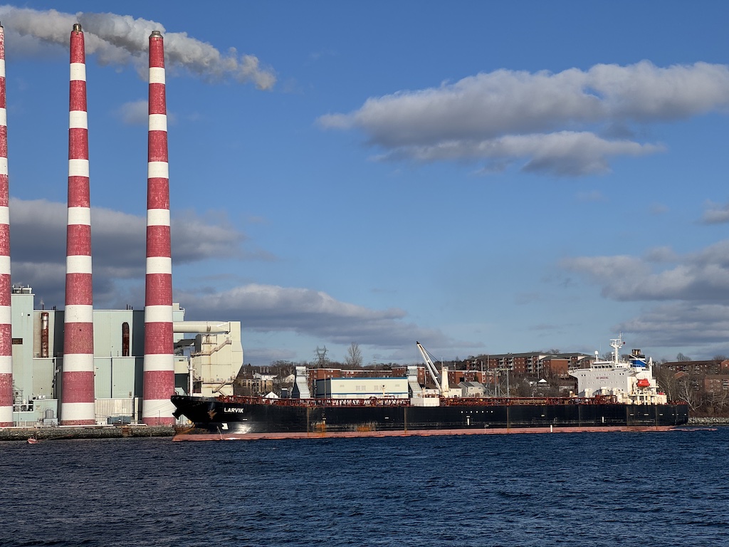
Larvik sailed from Houston, and arrived March 2. the ship was built in 2006 by Sumitomo Heavy Industries Marine & Engineering in Yokosuka Japan. its commercial operations are run out of Norway, but the ship is manged from Singapore.
On Feb 15, the container ship MSC Baltic III, Montreal for Cornerbrook, was sailing off the coast of Newfoundland when it lost power and drifted onto the shore. The 20 crew were rescued by an RCAF Cormorant out of Gander.
T&T marine salvage have been hired by MSC, and the coast guard is standing by, however work is being hampered by weather
View our Initial report:
And Latest update.
Crews are currently evaluating the situation. No pollution has been detected, however several containers have been damaged. and the hull is showing signs of stress.
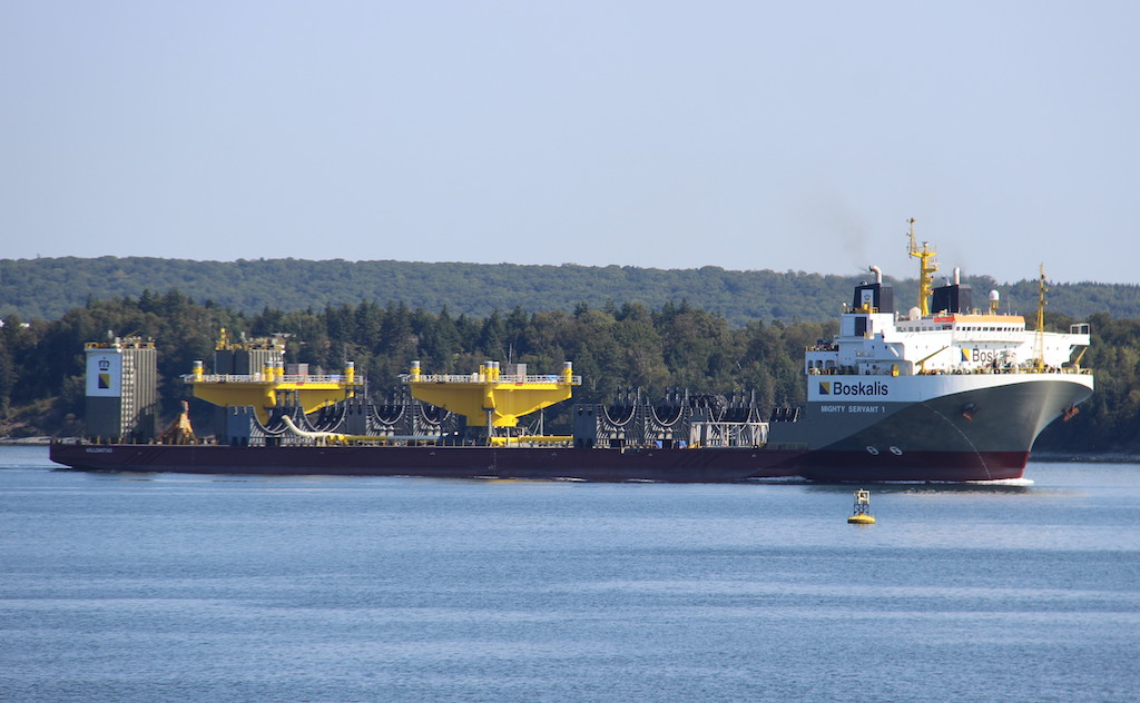
The famous Heavy lift Semi Submersible vessel Mighty Servant made a very brief stop in Halifax yesterday to swap some crew. the ship entered port, and was met by a Dominion diving vessel off Ives Knoll to perform the swap.
The ship then turned and headed out of the harbour, with the total stay in port of less then 5 minutes. The ship sailed from Cadiz Spain, bound for the US East Coast, with wind farm components. The ship will likely begin transporting towers from staging in Newfoundland, to the installation site, as other Boskallis vessels have been perfroming this work.
Nord Logos is currently at pier 9, installing cable handling equipment to transport undersea cable. two tanks are being installed in the hold, which will have cable laid into them for transport.
Nord Logos is one of several of this type of vessel that has called here in the past – the ships remain the same, but the charters change – These vessels have called under Thorco, Franbo, and now Nord Names.
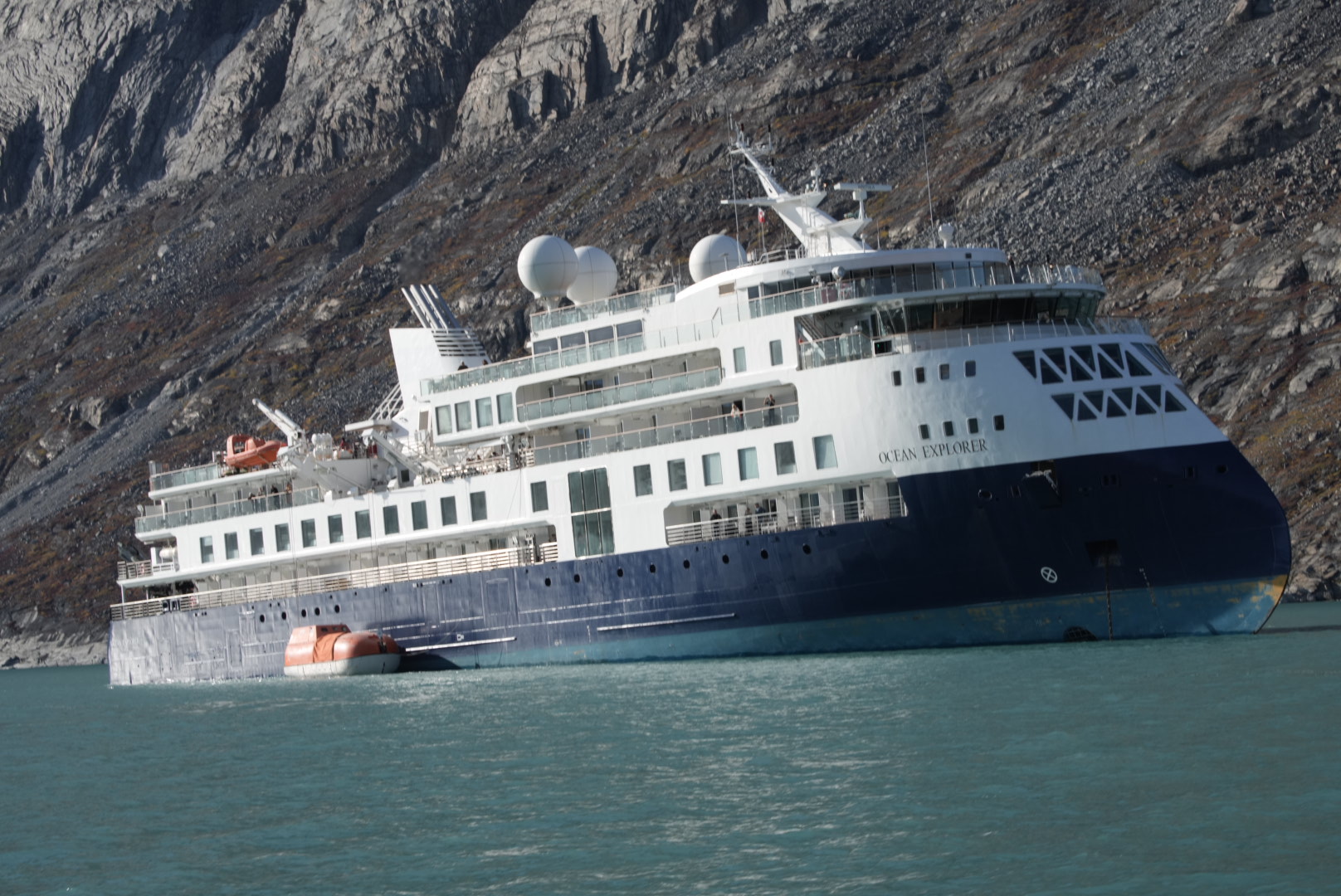
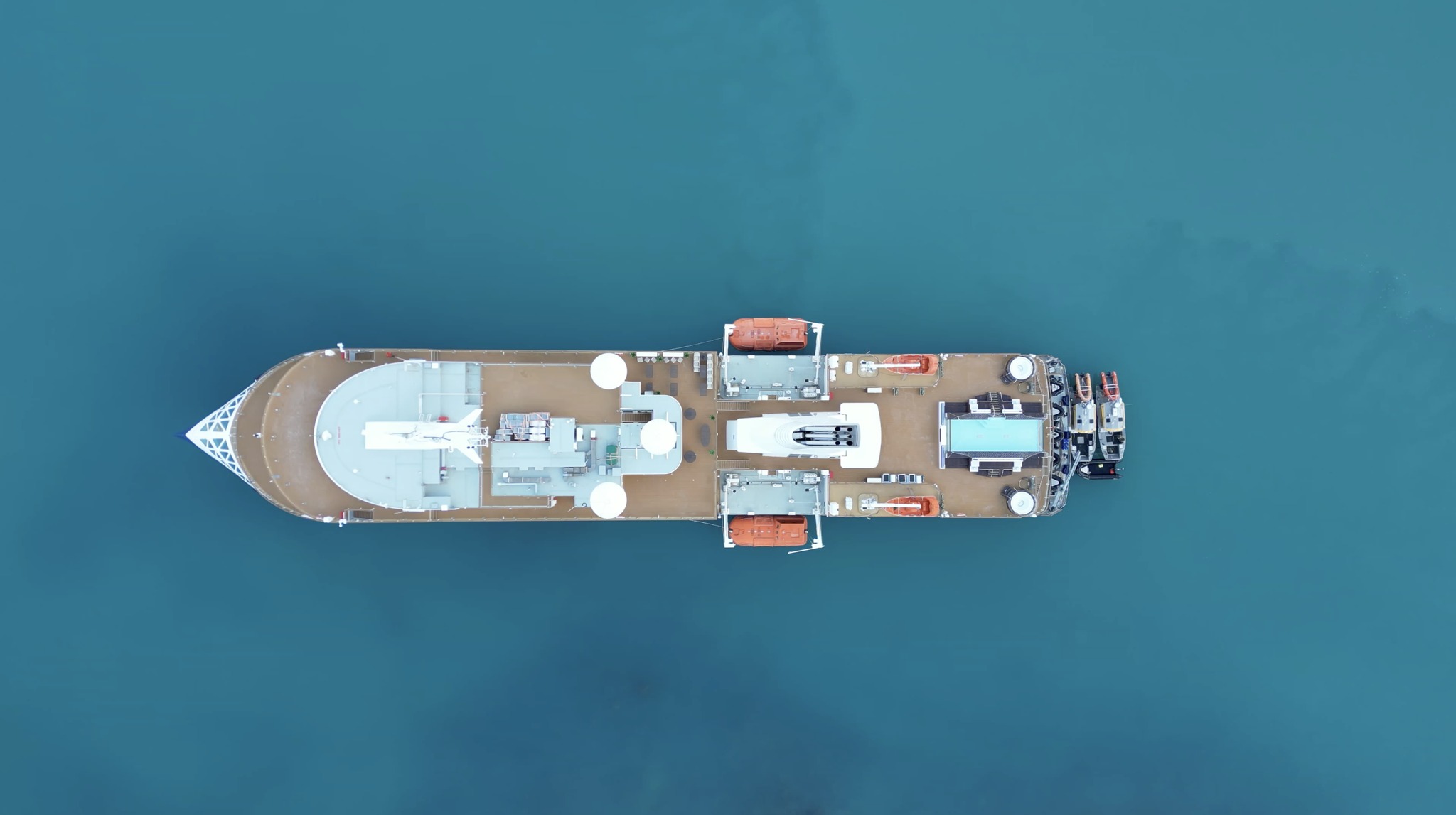
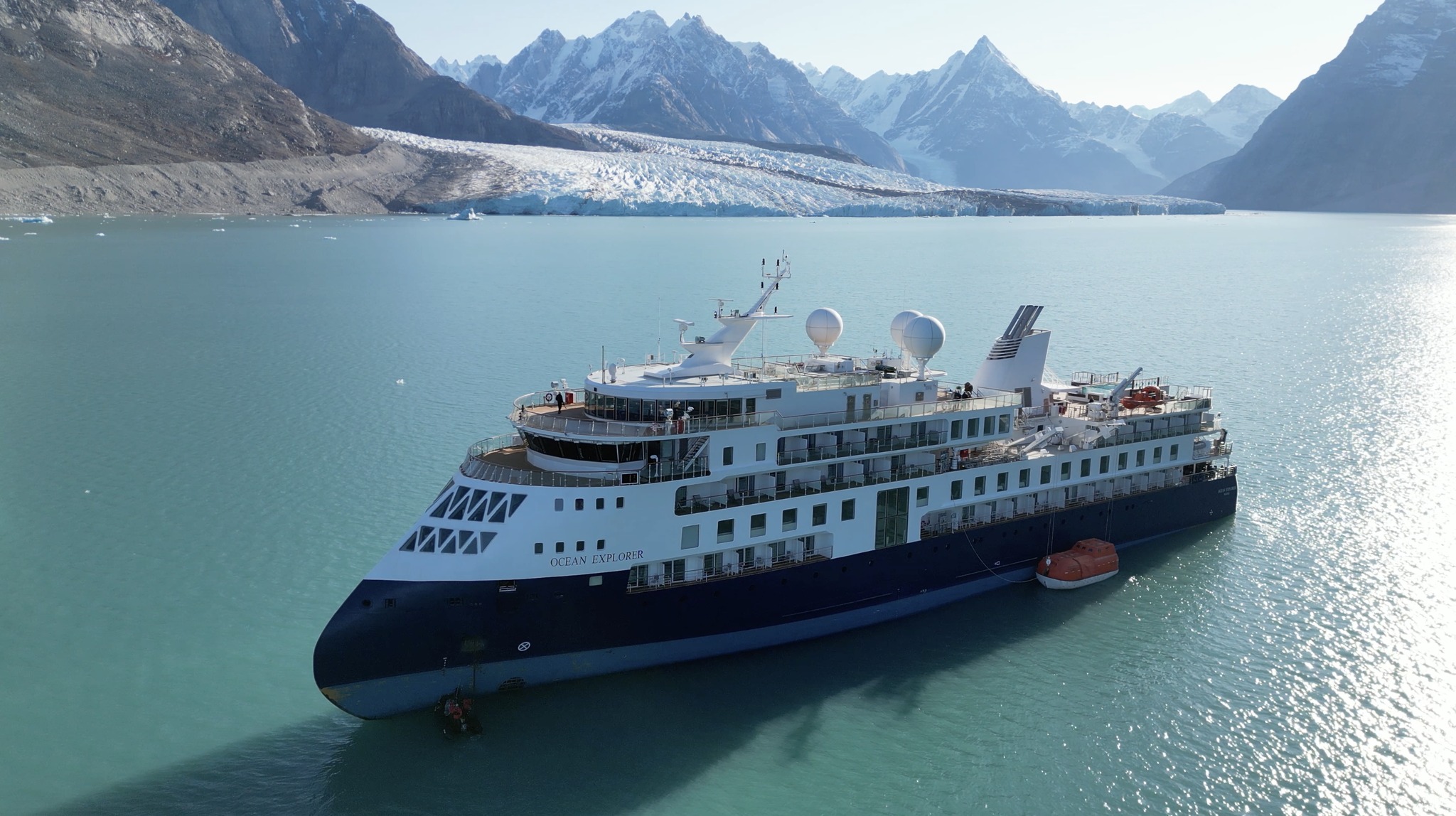
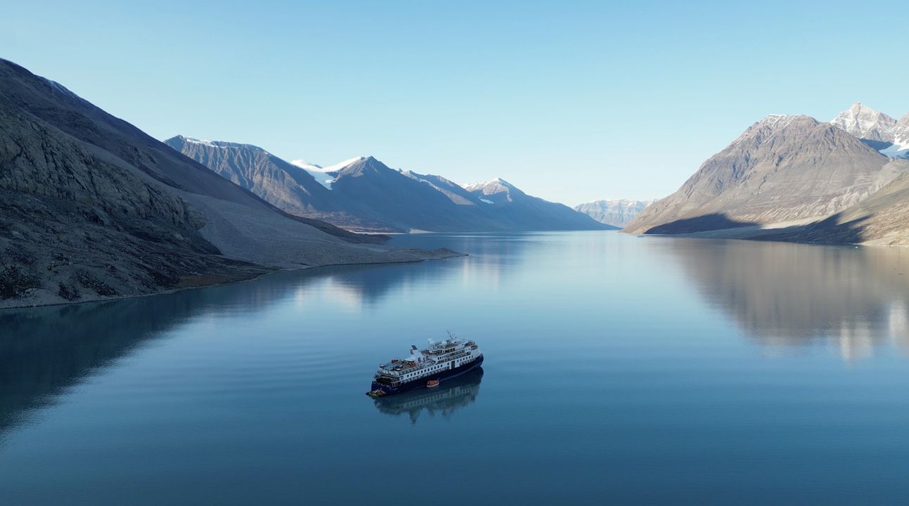
The Expedition Cruise ship Ocean Explorer grounded Monday in Alpefjord, within the boundaries of the North East Greenland National Park. the ship tried to free itself twice with out luck, and a third attempt with the Fisheries research vessel Tarajoq pulling also failed Wednesday.
The HDMS Kund Rasmussen, a Danish Offshore Patrol vessel is due late Friday. the Sirius Sled Dog Patrol, a unit of the Danish Navy, is on scene with 2 small boats, and is providing updates and imagery.
From the latest photos below, she looks to be well up on a ledge, that seems to drop off just below the lifeboats.
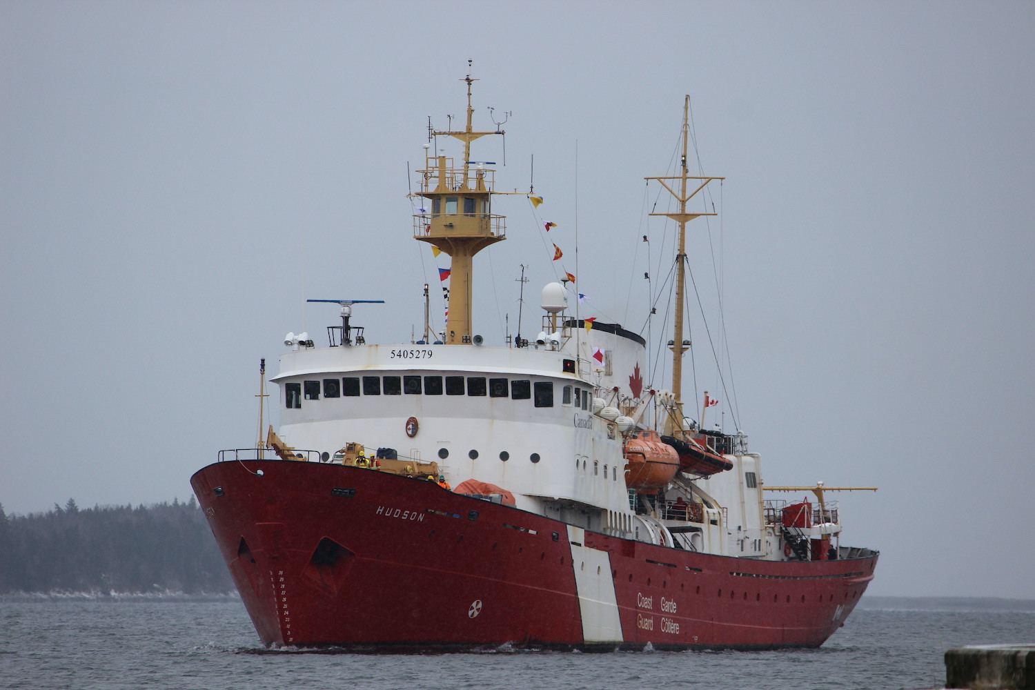
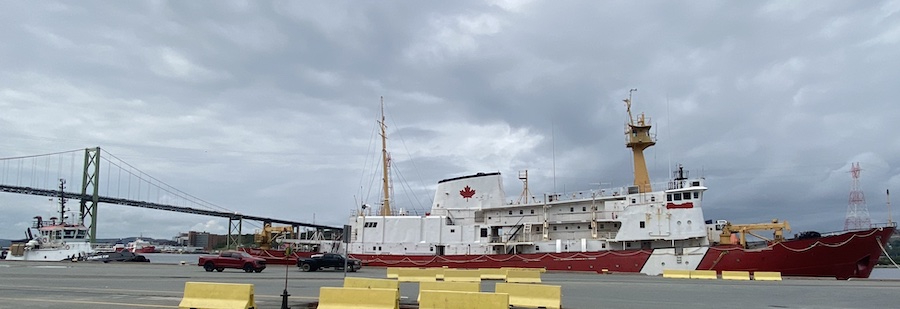
The CCGS Hudson, will be towed from Pier 9 this evening, bound for sheet harbour where she will be recycled. The pilot order is tentatively for 1700.
The ship suffered a motor winding failure, and sailed into Halifax in January 2022 for the Last time. The ship was sold for scrap, with the recycling contract going to RJ MacIsaac Construction. Prep work has been done at pier 9 over the last number of months, while waiting for the Holiday Island recycling to finish.
(Above) Hudson, and Atlantic Fir just prior to departure.
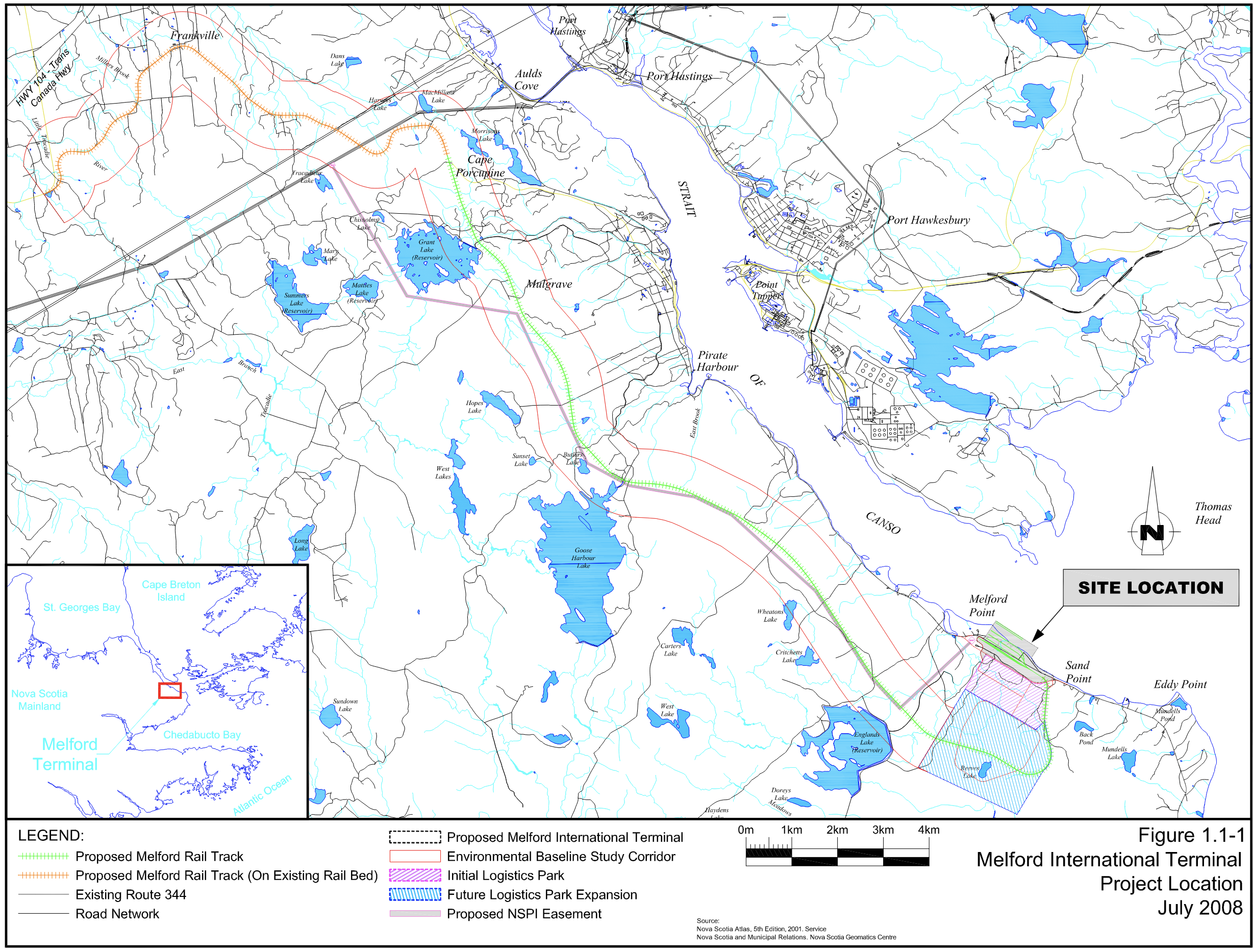
The Proponents behind the Melford Container terminal in the Straight of Canso have applied for Federal National Trade Corridor fund the Minister confirmed yesterday. The application is in the late stages of being evaluated. The terminal First proposed in 2008, has an approved environmental assessment, and an approval from the province of Nova Scotia to begin construction by October 2024.
SSA Marine, Melford International Terminal and Cyrus Capital Partners, L.P. have formed a joint venture to build the terminal, with SSA Marine to be the operator.
The 4.7 billion dollar national trade corridors fund has been contributing to projects across the country. The ports on Vancouver ($348.8million), Prince Rupert ($117.4million)received substantial funding for projects. however the three main ports on the east coast have received comparatively little.The Port of Montreal received $43.9million for three projects. the The following are Port related projects on the East Coast funded by the NTCF at Port of Saint John NB ($45million):
CBSA Container Examination Facility – 2.8million
West side terminal RO/RO expansion – 21million
NB Southern railway Upgrades – 21.2million
And in Halifax ($48million):
CBSA Container examination facility – 7million
Container terminal optimization – 18million
Windsor street exchange upgrades – 23million
The three main east coast Ports received only 136.9 million in funding, which is 25% of what BC ports received, and is less then the $150 million ask by the Melford terminal backers who only have projections and a business plan at this point.
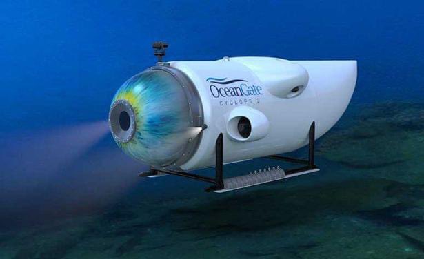
The Titan Submersible, operated by OceanGate Expeditions has gone missing on a trip to the titanic wreck site. The Polar Prince was serving as mothership for the Expedition.
we know know that the submersible went missing 1 hour and 45 minutes into the dive. It takes around 2 hours to reach the titanic from the surface. dive preparations began around 4am Sunday morning, with the dive beginning at 6am, suggesting the submersible has been missing since 8am Sunday. the USCG indicated they were informed the submersible was missing Sunday afternoon. Word of the missing vessel got out around 10am AST Monday. The Titan submersible can support life for 96hours.
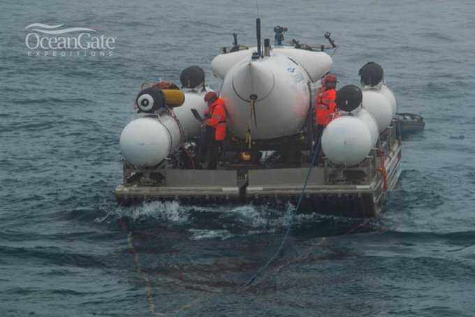
The Response is being co-ordinated by USCG NorthEast sector, based out of Boston. the USCG sent 2 c-130 aircraft to search the surface incase the submersible had surfaced. the 106th US Air national Guard also has c-130’s searching. the RCAF sent a C-130 to search, and a CP-140 Aurora was dispatched to deploy sonobouys to listen to for possible signs of the submersible. Polar Prince is equipped with sonar.
The CCGS Kolpit Hopson 1752 is on scene, the Horizon Arctic was initially dispatched, but has since turned back for St. John’s, replaced with the Skandi Vinland, equipped with an ROV.
the Titan Submersible is rated to 4000m (13123′) of depth. Its constructed of carbon fiber and titanium, and propelled by 4 innerspace 1002 electric thrusters. Titan is 23′ long, 9.2’wide, and 8.3’tall. it carries a pilot and crew of 4.
there are several possibilities as to what happened. the first possibility is an electrical issue, and the sub is unable to propel itself or surface. its possible the submersible is snagged on the wreck itself, and unable to move as a result. the last possibility is that the Titan suffered a structural failure, and was crushed.
Retired RN Rear Admiral Chris Parry indicated he has been contacted by a reliable informant who claims to have warned about structural issues in the Titan 5 weeks ago. Reporter David Pouge took a trip on Titan last year. That saw Titan go missing for several hours, though in that instance it was in communication with the mother ship. his stories are interesting, the sub is controlled by an xbox controller. Pouge indicates that Titan has several redundant systems to enable the submersible to surface, including air bladders and ballast. (Pouge’s report was for CBS, and it is available on Youtube, but not to Canada.
I have been maintaining a twitter thread on this story, continuously updated. This post will get updated, likely at the end of the day.
UPDATES: on Tuesday it was reported that knocking was heard by the CP-140 aircraft. ROV searches were adjusted to focus on the area where the knocking was detected.
The USAF flew three c-17’s of equipment to St Johns, and it was loaded aboard the Horizon Arctic. the Equipment includes a Pelagic ROV system, and the USN’s Fly Away Salvage system. Horizon Arctic Sailed for the site at 5 am Wednesday, its a 20 hour sail.
Also due tonight is the french research vessel L’Atalante. It’s operated by French research institute Ifremer, and was requested by the USN. The Victor 6000 is an autonomous robot, good to 6000m.
More stories about Ocean Gate Expeditions have been coming out. First were the details of lawsuits with a former employee who was fired after raising safety concerns, including that the porthole manufacturer would only certify it to 1300m and not 4000. Additional Stories are coming out about previous passengers who took a trip on the submersible.
the 96hours of life support runs out Thursday morning. that is likely not a hard deadline, but time is running out for a rescue.