
I have been getting alot of questions about the Crane Ship Thialf currently in the approaches. Thus, I present this Q&A
Q: Why is it Here?
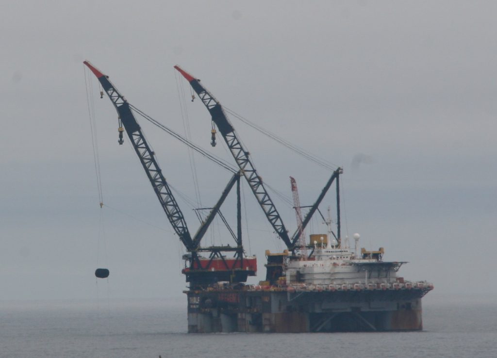
The Thialf is here to remove the topsides and Jackets from the Sable offshore filed. the Crane will lift the topsides, and put them on a barge. the barge will then be taken to sheltered waters, where it will be fastened for sea, and then taken to the UK for recycling. There are 7 platforms, so probably 14 total removals. (the jackets are the platforms legs sitting on the sea floor)

Q: Why is it not entering the Harbour?
Cheaper to anchor out there, Plus no need to pay for pilots, tugs and anchorage in the harbour. Vessels like this have support vessels to bring supplies to them, in this case Atlantic Kestrel and Bylgia.
Bylgia traveled from Amsterdam with the Thialf
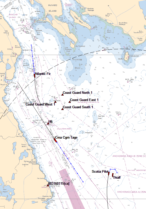
Q:Where is it Anchored?
about 3nm East of Chubucto head.
Q: Wasen’t it here before?
One of Heerema’s smaller crane ships, Hermod, was here around 2003. The original Sable Offshore installations were performed in 1998 by the Saipem 7000
Q: If this is the second largest, Whats the largest?
Fleet mate Sleipnir. Built last year, it can lift 20,000tons. The Saipem 7000 is the third largest.
Q: you didn’t answer my question..
Ask it in a comment to this post, and i will
Hi! How long will the crane ship be here and where is a good place to take my family to see it from the car? (Considering park restrictions right now). Any recommendations?
Thanks!
not sure how long.
It may be a while, due to COVID Concerns.
As for Viewing, eastern passage or Ketch Harbour Rd will give you a good view.
Thank you! Saw it from Eastern Passage a few days ago but it was so far away. Will look into Ketch Harbour. Thank you
I’m curious to know what software or website you used for the map showing the location of the Thialf. Thanks.
I am the original data supplier to marinetraffic.com for Halifax. The AIS Receiver is connected to a PC which runs ShipPlotter. – that sends Data to Marinetraffic, and also displays it on screen. I just display it against an old edition CHS raster chart.
Nice. I use marinetraffic.com all the time to see what’s happening around Atlantic Canada. Really liked that map as it provides so much more information and detail than marinetraffic.com. Love your website too. I check it daily.
I think that Thialf might be actually considered a barge and Byglia towed it over to Nova Scotia. I enjoy your work. Thanks
nope, its self propelled. it uses azipods to move, as well as dynamic position.